Gallery:Newtownards
From Roader's Digest: The SABRE Wiki
Jump to navigation
Jump to search
This gallery has no child categories
Newtownards
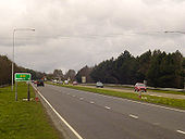
Kempstones Road
The A20 rises out of Newtownards bound for Dundonald and Belfast
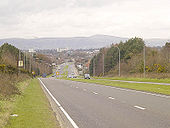
Originally uploaded to Coppermine on Jun 22, 2006 by exploDundonald
Peering down into Dundonald on the A20 dual carriageway from Newtownards
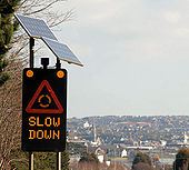
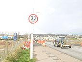
Originally uploaded to Coppermine on Jun 22, 2006 by exploIrish 30 sign
This Irish '30' sign appeared in roadworks in Newtownards, County Down during March 2009. Note the different font and the tape, which covers up km/h.
Originally uploaded to Coppermine on Mar 08, 2009 by exploNewtownards from Scrabo 2010-6
See <a href='http://www.geograph.org.uk/photo/1665202'>J4874 : Newtownards from Scrabo (1980)</a>. The Scrabo Road roundabout.
See <a href='http://www.geograph.org.uk/photo/1665202'>J4874 : Newtownards from Scrabo (1980)</a>. The Scrabo Road roundabout.
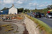
The Portaferry Road near Newtownards
The Portaferry Road (looking towards Newtownards), as it passes the shore of Strangford Lough (left), at Ballyreagh.
The Portaferry Road (looking towards Newtownards), as it passes the shore of Strangford Lough (left), at Ballyreagh.
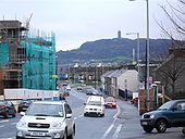
Donaghadee Road, Newtownards
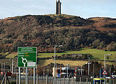
Looking down towards the town centre and Scrabo Tower - which dominates the town.
Looking down towards the town centre and Scrabo Tower - which dominates the town.
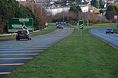
New road, Newtownards (5)
See <a href='http://www.geograph.org.uk/photo/1567056'>J4873 : New road, Newtownards (4)</a>. The road passing the Jubilee Business Park. The Comber Road roundabout is at top right and the West Winds estate out of picture to the right.
See <a href='http://www.geograph.org.uk/photo/1567056'>J4873 : New road, Newtownards (4)</a>. The road passing the Jubilee Business Park. The Comber Road roundabout is at top right and the West Winds estate out of picture to the right.
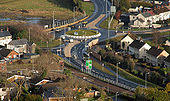
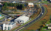
New road, Newtownards (4)
See <a href='http://www.geograph.org.uk/photo/1094760'>J4873 : New road, Newtownards (3)</a> and <a href='http://www.geograph.org.uk/photo/1295615'>J4973 : The view from Scrabo (4)</a>. The whole road is now open to traffic. The view shows the Portaferry Road roundabout (top), the Castlebawn roundabout (middle) which will provide access to the proposed shopping centre and (bottom) the Comber Road roundabout. For through traffic from Belfast to Portaferry the road is a great benefit. There are, however, reports that things are not quite so easy for peak traffic heading out towards Comber. Continue to <a href='http://www.geograph.org.uk/photo/1567181'>J4873 : New road, Newtownards (5)</a>.
See <a href='http://www.geograph.org.uk/photo/1094760'>J4873 : New road, Newtownards (3)</a> and <a href='http://www.geograph.org.uk/photo/1295615'>J4973 : The view from Scrabo (4)</a>. The whole road is now open to traffic. The view shows the Portaferry Road roundabout (top), the Castlebawn roundabout (middle) which will provide access to the proposed shopping centre and (bottom) the Comber Road roundabout. For through traffic from Belfast to Portaferry the road is a great benefit. There are, however, reports that things are not quite so easy for peak traffic heading out towards Comber. Continue to <a href='http://www.geograph.org.uk/photo/1567181'>J4873 : New road, Newtownards (5)</a>.
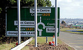
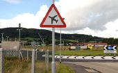
The Castlebawn roundabout, Newtownards (1)
The sign approaching the roundabout from the Portaferry direction. The white space will, doubtless, be filled by a patch when the shopping centre is built. There is also a �low-flying aircraft� sign (bottom right) to warn of the approach to the aerodrome <a href='http://www.geograph.org.uk/photo/837497'>J4972 : Runway, Newtownards aerodrome (2)</a>. Scrabo Tower <a href='http://www.geograph.org.uk/photo/775719'>J4772 : Scrabo Tower near Newtownards (3)</a> dominates the background. Continue to <a href='http://www.geograph.org.uk/photo/1683355'>J4973 : The Castlebawn roundabout, Newtownards (2)</a>.
The sign approaching the roundabout from the Portaferry direction. The white space will, doubtless, be filled by a patch when the shopping centre is built. There is also a �low-flying aircraft� sign (bottom right) to warn of the approach to the aerodrome <a href='http://www.geograph.org.uk/photo/837497'>J4972 : Runway, Newtownards aerodrome (2)</a>. Scrabo Tower <a href='http://www.geograph.org.uk/photo/775719'>J4772 : Scrabo Tower near Newtownards (3)</a> dominates the background. Continue to <a href='http://www.geograph.org.uk/photo/1683355'>J4973 : The Castlebawn roundabout, Newtownards (2)</a>.
The Castlebawn roundabout, Newtownards (3)
See <a href='http://www.geograph.org.uk/photo/1683355'>J4973 : The Castlebawn roundabout, Newtownards (2)</a>. The roundabout, looking in the direction of the Portaferry Road. Continue to <a href='http://www.geograph.org.uk/photo/1683427'>J4973 : The Castlebawn roundabout, Newtownards (4)</a>.
See <a href='http://www.geograph.org.uk/photo/1683355'>J4973 : The Castlebawn roundabout, Newtownards (2)</a>. The roundabout, looking in the direction of the Portaferry Road. Continue to <a href='http://www.geograph.org.uk/photo/1683427'>J4973 : The Castlebawn roundabout, Newtownards (4)</a>.
Roundabout linking the A2 to the Shore Road
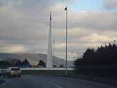
The monument at the roundabout linking the A2 to the Shore Road. This depicts the monks pointed hat in blue (Whiteabbey) and the white arrows the sails of a yacht.
The monument at the roundabout linking the A2 to the Shore Road. This depicts the monks pointed hat in blue (Whiteabbey) and the white arrows the sails of a yacht.
Hidden category:
