Gallery:Rookery Crossroads

From Roader's Digest: The SABRE Wiki
Jump to navigation Jump to search
Junctions in the East of England > Rookery Crossroads


This gallery has no child categories
Rookery Crossroads
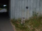
 
 
To Bury 3 - Geograph - 894349.jpg
To Bury 3 Old milestone for what was the A45 in new location after road reconstruction see http://www.geograph.org.uk/photo/894356 for info on the plaque near to Bury St.Edmunds Suffolk.
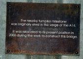
Information plaque - Geograph - 894356.jpg
Information plaque Information plaque for old milestone near to Bury St.Edmunds Suffolk. For view of the milestone see http://www.geograph.org.uk/photo/894349
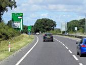
Westbound A14 near Rookery Crossroads - Geograph - 3853630.jpg
Westbound A14 near Rookery Crossroads
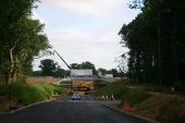
A14 roadworks - Geograph - 29460.jpg
A14 roadworks The minor road from Blackthorpe to Battlies Green has been diverted under the A14, where there are also major roadworks (July 2005) to iron out a dangerous bend.
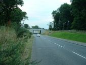
Underpass - Geograph - 894330.jpg
Underpass Underpass of a local road under the A.14 see http://www.geograph.org.uk/photo/29460 for the photo by Bob Jones of it being constructed in July 2005.
 

SABRE - The Society for All British and Irish Road Enthusiasts
Discuss - Digest - Discover - Help