Gallery:Torquay
From Roader's Digest: The SABRE Wiki
Jump to navigation
Jump to search
Places in the South West > Torquay
This gallery has no child categories
Torquay
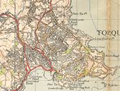
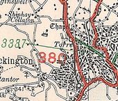
Torquay in 1946
This page contains scans from a map that is believed may be out of copyright according to UK Crown Copyright, UK Copyright Law for other maps published in the United Kingdom, or Irish Government Copyright, is not being used to generate profit in this context, and presents information that cannot be exhibited otherwise.
If the copyright holder considers this is an infringement of their rights, please contact the site management team to discuss further steps.
If the copyright holder considers this is an infringement of their rights, please contact the site management team to discuss further steps.
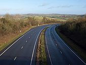
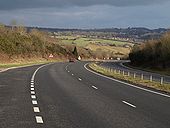
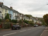
A379 Torquay
This is a random photo I took of the A379 that runs along the coast of south Devon. The road continues on the left.
Originally uploaded to Coppermine on May 01, 2007 by Halstead89B3337, Torquay, 1927
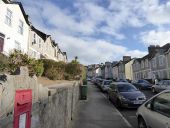
Westhill Road, Torquay
A steep hill and terraces of houses dropping down what used to be called Black's Hill.
A steep hill and terraces of houses dropping down what used to be called Black's Hill.
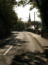
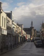
St Marychurch Road, Torquay
The main road from St Marychurch and Plainmoor descends towards Castle Circus. The spire belongs to Upton church. Taken a few metres from the junction with Ash Hill Road.
The main road from St Marychurch and Plainmoor descends towards Castle Circus. The spire belongs to Upton church. Taken a few metres from the junction with Ash Hill Road.
Union Street, Torre
Higher Union Street is also shown in SX9164 : Union Street, Torre, SX9164 : Union Street, Torre and SX9164 : Union Street, Torre]. The turret is on Castle Chambers - see SX9164 : Castle Chambers, Torquay].
Higher Union Street is also shown in SX9164 : Union Street, Torre, SX9164 : Union Street, Torre and SX9164 : Union Street, Torre]. The turret is on Castle Chambers - see SX9164 : Castle Chambers, Torquay].
