Gallery:Winchester
Article from The Times of Wednesday, Sept 25, 1929
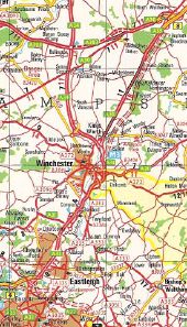
Originally uploaded to Coppermine on Sep 04, 2007 by DavidBTaken from 1982 Collins Atlas of Britain. Part of the M3 shown as under construction to Winchester, and the middle bit of the M27. The remodelling of the A33 to M3 was to come much later. A303 shown as being dualled east of Bullington, with A30 following its original course. Originally uploaded to Coppermine on Feb 18, 2007 by BobSykes
This page includes a scan of a non-free copyrighted map, and the copyright for it is most likely held by the company or person that produced the map. It is believed that the use of a limited number of web-resolution scans qualifies as fair use under United States copyright law, where this web page is hosted, as such display does not significantly impede the right of the copyright holder to sell the copyrighted material, is not being used to generate profit in this context, and presents information that cannot be exhibited otherwise.
If the copyright holder considers this is an infringement of their rights, please contact the Site Management Team to discuss further steps.
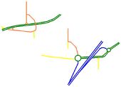
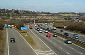
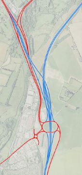
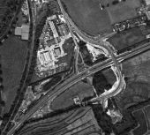
Top left: the layout prior to the M3 and Twyford Down (the A33 to the right of the junction was upgraded to the M3 in 1985 but the junction kept the same).
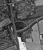
Bottom Right: the current junction layout at M3 J10, incorporating the old flyover for Bar End Road and slip road for Garnier Road.
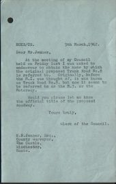
Originally uploaded to Coppermine on Nov 27, 2006 by sotonsteveWas the Trunk Road 8 numbering just for Hampshire C.C. or, a national list? The number referred to the A30 but was being used for the new road, before M3 came into use.
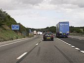
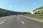
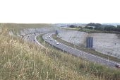
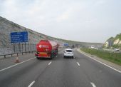
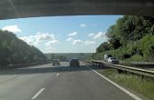
Originally uploaded to Coppermine on Dec 16, 2008 by SteveA30The northbound M3 motorway passing the exit slip road (A31 for Winchester) at Junction 10.
A few years after completion: less raw than it was, but still a scar in the hill.
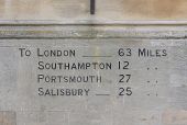
These mileages are carved into the stonework at the eastern end of the Guildhall on the Bargate and about 100 metres from King Alfred's statue. They may have been put there when the building was constructed in 1873.
Five Bridges Road, the former A333 Winchester to Portsmouth road across the Itchen water meadows south of Winchester
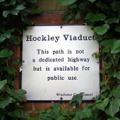
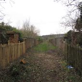
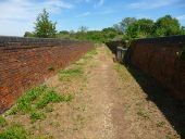
At each end of the Hockley Viaduct there is a sign like this. Winchester City Council bought the land along the line after its closure in 1968, including the viaduct. Steps have been put in at the Five Bridges Road end of the viaduct and the (potentially) dangerous gaps in the viaduct wall have been fenced off making it 'safe' for public use.
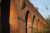
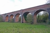
The Hockley Viaduct, which once carried the Southampton to Newbury railway across the Winchester Water Meadows. In the 1980s the local council planned to engage the army to blow up the viaduct, but it was later opened as a permissive footpath. In late 2011 funding was agreed to repair the viaduct and use it to carry National Cycle Route 23 which runs from Reading to the Isle of Wight. See <a title='http://www.winchester.gov.uk/TransportAndStreets/WalkingAndCycling/IContent.asp?id=SX9452-A7862FF0&cat=7856' rel='nofollow' href='http://www.winchester.gov.uk/TransportAndStreets/WalkingAndCycling/IContent.asp?id=SX9452-A7862FF0&cat=7856'>Link</a><img style='padding-left:2px;' alt='External link' title='External link - shift click to open in new window' src='http://s1.geograph.org.uk/img/external.png' width='10' height='10'/>.
This former railway viaduct was opened in March 1891. It was part of the Didcot, Newbury & Southampton Railway, although the viaduct was built by the larger London & South Western Railway. Rail traffic ceased in 1965, and it now a footpath. The viaduct is now owned by Winchester City Council.
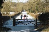
This straight road follows the course of a Roman Road that led south out of Winchester (Venta Belgarum) to Bitterne (Clausentum) near Southampton. This stretch of the road is lined with tall beeches.
The viaduct, originally called the Twyford Viaduct, was built in the 1880s by the London and South Western Railway (LSWR). It provided a link over the River Itchen and water meadows, from the Didcot, Newbury and Southampton Railway (DNSR), to the LSWR's main line.
Here's a very simple way of making the the A34 freeflow onto the M3 without any major alterations to the existing road network. There's enough space in the A33/A34 split for a new road to be built through the middle and this simply joins the M3 at the North side of J9. The only alterations required are lengthening the existing North facing J9 slips to allow the new freeflow to be built beneath. Simple eh! No buildings need demolishing either.
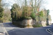
Originally uploaded to Coppermine on Dec 23, 2007 by TruveloQuarry Road is to the left, Petersfield Road to the right. Photographed from the top of East Hill. Note the magnificent wall, faced with flints.
Just in case people in Winchester have forgotten what a recently resurfaced footway is like!
It has not technically been resurfaced; it has had a layer of loose chippings applied to the knackered surface underneath.
Originally uploaded to Coppermine on Dec 05, 2005 by sotonsteve