Gravelly Hill
| Gravelly Hill | |||
| Location Map ( geo) | |||
 | |||
| |||
| Location | |||
| Gravelly Hill | |||
| County | |||
| Warwickshire | |||
| Highway Authority | |||
| National Highways | |||
| Junction Type | |||
| Unique | |||
| Roads Joined | |||
| M6, A38(M), A38, A5127 | |||
| Junctions related to the A5127 | |||
The infamous Spaghetti Junction, Gravelly Hill provides the interchange between the M6, A38(M), A38, A5127 and an unclassified road. It forms junction 6 of the M6. Movements are facilitated by means of a complex array of slip roads and a roundabout (called Salford Circus). All movements are possible except between the unclassified road and the A38(M), and between the A38(M) and the southbound A5127.
The nickname Spaghetti Junction is believed to have come from a journalist's remark in the mid 1960s, that described the then under construction junction as "cross between a plate of spaghetti and an unsuccessful attempt at a Staffordshire knot."

Despite its complicated appearance, Gravelly Hill is easy to negotiate because all of the movements are well signposted. Nevertheless, its reputation precedes itself enough to be voted the second most scariest junction in the UK in a 2007 BBC poll, and again as Britain's scariest road by Britannia Rescue, a breakdown firm.
In 1998 unusual diamond markings were painted between lanes one and two of the M6 westbound. Following a trial at the TRL lab, the new markings were joined by yellow signs explaining to through traffic "new road markings ahead" and "stay in lane through [diamond] markings": the theory was that this would reduce collisions approaching the junction. This was considered a success and the markings remained.
History

Early plans of the M6 showed a different design for the junction consisting of an elongated roundabout. This simpler design pre-dates plans for the A38(M) which the city council proposed much later.
The interchange was one of the last sections of M6 to be completed until the Cumberland Gap extension in 2008. The A38(M) meant a more complexed junction was required to handle the expected level of traffic. Tenders for construction were announced by the then transport minister, Richard Marsh, in July 1968, with construction starting later in the year. It opened to traffic on 24th May 1972 at a cost of £10.9M (approx 113M in 2011).
In a press release when the junction opened, the engineers claimed it had been "carefully designed to provide for all the movements and yet keep the effect on land and property to a minimum". It was built mostly over allotments and a boating lake, with the River Tame and canal needing to be realigned.
The completion of the last section of the M6 through the Midlands had a knock on effect of traffic, much of which diverted from the A5 onto the new motorway. By the late 1970s, urban road building of this style had fallen out of favour, with local MP Robin Hodgson noting that many residents had complained about the increased noise along the whole stretch of M6 in the area. Similarly, Julius Silverman, then MP for Birmingham Erdington, had called for noise screening barriers to be erected around the junction.
In 2012, the junction was used as part of an art exhibition for Birmingham's Fierce Festival.
Routes
| Route | To | Notes |
| The NORTH WEST & B'ham (N & W), The South West (M5) | ||
| London (M1), (M42 & M40), N.E.C & B'ham Airport | ||
| B'ham (City, E & Cen.) | no access to Salford Circus | |
| (M6 Toll (N)), Birmingham (NE), Lichfield, Fort Shopping Park | ||
| Sutton Coldfield 4, Erdington 1 1/2 | ||
| City Centre 4, Aston 1 3/4, Fort Dunlop | ||
| Stockland Green 3/4, Ellenki Kypraiki Estia Orthodox Church of St Lukes, Ghausia Mosque |
Strip Maps
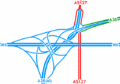
The current layout of the interchange.

Links
BBC News


_Tyburn_Road_slips_-_Coppermine_-_8881.jpg)