Hirta Roads
| Hirta Roads | |||
| Location Map ( geo) | |||
| |||
| From: | Village Bay (NF102990) | ||
| To: | Mullach Mor (NA092001) | ||
| Distance: | 4 miles (6.4 km) | ||
| Highway Authorities | |||
| Traditional Counties | |||
The Island of Hirta in the St Kilda Archipelago lies to the west of Harris in the Outer Hebrides. Officially unoccupied since 1930, there are nevertheless a small team of people living on the island each summer, comprising military personnel and conservationists from the various charities and organisations who help look after the islands. To facilitate the movement of the military in particular, there are 2 paved roads, in addition to the village 'street'. None of the roads are public roads, and there are very few vehicles on the island, those that are present belong either to the military, their contractors, or the conservation groups.
The Street
Think of St Kilda, and most peoples first image is of the row of roofless cottages sitting in a curved line around the bay. The fact that several of the cottages at the eastern end are preserved with roofs escapes many, as does the distance from the shore to The Street, which is about a couple of hundred metres.
Historically St Kildans built Blackhouses to suit their needs and abandoned houses would be used for storage, however in the 1880s a Hurricane is reported to have destroyed the occupied houses of the time. The factor brought modern housing techniques to the island and a "street" of houses was formed with a rough track running from the Church at the pier up to the factors house and along the front of the houses.
Most of the Streets surface is now grass however there was evidence in places of rocks having been placed in order to pave the track and the under foot feel of sections where this was not visible indicated there was something more substantial under the earth. The famous "St Kilda Parliament" [1] photograph confirms that the street had a form of paving.
Mullach Mor Road
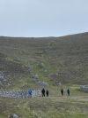
The main military road on the island starts at the pier and feather store to the east of the village before passing the MOD base and runs across the head of the bay, a couple of hundred meters below the street. It then turns northwards towards a quarry and then ascends a series of switchback bends up the steep hillside, before turning north again to climb the ridge to the Mullach Mór radar station, at the second highest point on the island. The road is very steep at times, and although the surface is concrete it can be rough in places with many patches. Single height Barriers protect the more precipitous edges.
Mullach Sgar Road
Just before the main military road reaches the ridge, it meets a T junction at Am Blaid. Here, a spur turns south east and skirts the cliff tops of Mullach Sgar, passing a transmitter tower and coming to an end at a turning head above Ruabhal. The surface is formed of a rough tar.
The Gap
Although not claimable as a road this is the route up to the cliff edge and the wide well trod path is compulsive walking for any visitor; striking out from the street near the museum the most obvious path leads through the blackhouses, sheep flanks and storage cleats, and as the valley closes in the village ends and a line of cleats lead you to the cliff edge where you can strike out to summit either the Easterly peak of Oiseval or aim for the island summit of Connachair. The clearest and easiest routes up each being along the very edge of the cliff, those with a dislike for "exposure" may well prefer to take a steeper inland route on the grass.
Walking on Hirta also presents the danger of passing close to a nesting site where the birds will be prepared to protect their nest by attacking you.
| Hirta Roads | ||
|


