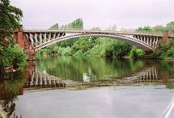
Holt Bridge
| Holt Bridge | |||||||||
| Location Map ( geo) | |||||||||
 | |||||||||
| Holt Bridge in 2005 | |||||||||
| |||||||||
| From: | Holt Heath | ||||||||
| To: | Holt Fleet | ||||||||
| County | |||||||||
| Worcestershire | |||||||||
| Highway Authority | |||||||||
| Worcestershire | |||||||||
| Opening Date | |||||||||
| 1828 | |||||||||
| Additional Information | |||||||||
| |||||||||
| On road(s) | |||||||||
| A4133 | |||||||||
Holt Bridge (also commonly referred to as Holt Fleet Bridge) is a grade 2 listed crossing of the River Severn on the A4133 which links the A443 to Ombersley (A449) and Droitwich (A38).
Following structural inspections of the bridge, an emergency 7.5 tonne weight limit was imposed from 27 April 2009, with strengthening works planned for the near future.
History
Prior to the construction of the bridge, a ferry used to operate across the Severn in roughly the same spot. The bridge was designed by Thomas Telford and built by William Hazledine. Construction on the bridge started in 1826 and it opened in 1828. It was widened and reinforced in 1928.
During World War 2, mines were placed in the bridge to protect against German invasion, along with anti tank posts.
| Holt Bridge | ||
| ||
|


