Star.pngStar grey.pngStar grey.pngStar grey.pngStar grey.png

Kenninghall

From Roader's Digest: The SABRE Wiki
Jump to navigation Jump to search
Kenninghall
Location Map ( geo)
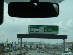
A406 (Edmonton) - Coppermine - 5554.JPG
Cameraicon.png No pictures uploaded (Upload?)
Location
Kenninghall
County
Middlesex
Highway Authority
Transport for London
Junction Type
Modified Diamond
Roads Joined
A406, A1055

Kenninghall is a Grade Separated Junction on the A406.

It replaced an old T Junction between Montagu Road and Angel Road. Angel Road was dualled as part of the North Circular in the 1960s, while many of the houses in this area were demolished in the 1970s.

The main flyover and the link to the A1055 were built in the 1990s.

Routes

Route To Notes

A406

N Circular (W), (A10, A1) (M1), Wood Green, Enfield, Edmonton, Hospital

A406

N Circular (E), (M11) (A12, A13), Walthamstow, Industrial Estates, Chingford (A1009)

A1055

Tottenham, Brimsdown possibly actually A1204
Local Traffic


Kenninghall
Junctions on the North and South Circular Roads
North CircularChiswick Roundabout • Gunnersbury Park • Ealing Common • Hanger Lane • Park Royal • Stonebridge Park • Neasden Junction • Staples Corner • Brent Cross • Henlys Corner • High Road • Colney Hatch • Clockhouse Junction • Great Cambridge Junction • Angel Edmonton • Kenninghall • Cooks Ferry • Hall Lane • Crooked Billet • Waterworks Corner • Gates Corner • Child's Corner • Woodford • Charlie Browns • Redbridge • Ilford Bridge • Wallend • Beckton Roundabout • Gallions Roundabout
South CircularWell Hall Roundabout • Yorkshire Grey • Cliftons Roundabout • Catford Gyratory • Forest Hill • The Grove • Tulse Hill • Wandsworth Gyratory • Red Rover • Milestone Green • Chalkers Corner • Kew Green • Kew Bridge • Chiswick Roundabout

SABRE - The Society for All British and Irish Road Enthusiasts
Discuss - Digest - Discover - Help