Star.pngStar grey.pngStar grey.pngStar grey.pngStar grey.png

Knutsford services

From Roader's Digest: The SABRE Wiki
Jump to navigation Jump to search
Knutsford services
Location Map ( geo)
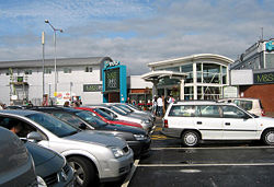
M&S at Knutsford Services - Geograph - 954047.jpg
Cameraicon.png View gallery (25)
Location
Knutsford
County
Cheshire
Opening Date
1963
Current Operator
Moto
On road(s)
M6
Globe.png
For detailed information about this topic, see Motorway Services Online, Motorway Services Info and MSA Trivia


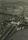
The services on the 1964 OS Quarter Inch map

Knutsford services is located on the M6 in Cheshire, just south of junction 19. It opened in 1963 along with this section of the motorway.

Since 2000, HGVs have been discouraged from using the services due to the lack of space for parking, and instead have been directed towards Lymm services.

Its local exits are located on the A5033.


Knutsford services
Related Pictures
View gallery (25)
Knutsford Service Station - Geograph - 462621.jpgMoto, Knutsford Motorway Services - Geograph - 646329.jpgSpeeding towards M6 Knutsford Services - Geograph - 857147.jpgView from Knutsford Services in 1991 - Coppermine - 13866.jpgIllus-London-News-3-Sep-66--Knutsford-Services.jpg
Services on the M6
ExtantRugby • Corley • Hilton Park • Stafford (South) • Stafford (North) • Keele • Sandbach • Knutsford • Lymm • Charnock Richard • Lancaster (Forton) • Carnforth • Burton-in-Kendal • Killington Lake • J38 truckstop • Tebay • Southwaite • Todhills
UnsignedCrewe • Tickled Trout • Golden Fleece
ProposedSwinford • Harborough Magna (Stretton-under-Fosse) • Perry Barr • Essington • Doxey • Woolston • Winwick • Haydock Park • Melkinthorpe


SABRE - The Society for All British and Irish Road Enthusiasts
Discuss - Digest - Discover - Help