Largs Avenue (North Ayrshire)
| Largs Avenue (North Ayrshire) | ||||
| Location Map ( geo) | ||||
 | ||||
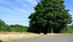
| Largs Avenue emerges from woodland near the A78 | ||||
| ||||
| Largs Avenue | ||||
| From: | U35 Old Road/Netheron Avenue | |||
| To: | Fence at Power Station Road | |||
| Distance: | 0.4 miles (0.7 km) | |||
| Meets: | Power Station Road (North Ayrshire) | |||
| Highway Authorities | ||||
| Traditional Counties | ||||
| Route outline (key) | ||||
| ||||
North Ayrshire's Largs Avenue road is 0.446 miles and was once the main access to Hunterston Estate. The road used to start at the A78 but when the Power Station Road was constructed in the 1950s the road was cut in two and access was via a small gate from the Power Station Road. The road was once again cut in two when the Oilrig Road was built and only 50 meters remains in use.
The full length road passed over an 19th century bridge called "Hunterston Bridge" and the main Hunterston North Pillars were located at the A78 but was relocated to Netherton Avenue in 1970.
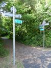
The part of the road between the Oilrig Road and the fence of the Power Station Road is now overgrown but the road surface remains. The part between Power Station Road and the A78 is now used as a cycle path.
The full road although not in use is still designated as the U35.
Links
| Largs Avenue (North Ayrshire) | ||
|


