List of Level Crossings in the North East
Jump to navigation
Jump to search
Below is a list of level crossings in the North East of England.
This list is incomplete; you can help by expanding it.
| Image | Name | Number | Road Name | Location | County | Authority | Map | Notes |
|---|---|---|---|---|---|---|---|---|

|
Spittal Crossing | unclassified | Cow Road | Spittal, Berwick upon Tweed | Northumberland | Northumberland | ||

|
Scremerston Crossing | unclassified | Scremerston | Northumberland | Northumberland | |||

|
Goswick Crossing | unclassified | Goswick | Northumberland | Northumberland | |||
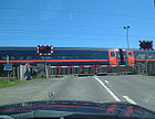
|
Beal Crossing | C16 (Northumberland) | Holy Island Road | Beal | Northumberland | Northumberland | On East Coast Mainline | |

|
Fenham Low Moor Crossing | unclassified | Northumberland | Northumberland | ||||

|
Smeafield Crossing | C59 (Northumberland) | Smeafield | Northumberland | Northumberland | |||

|
C60 (Northumberland) | Cragmill | Northumberland | Northumberland | ||||

|
Belford Crossing | B1342 | Station Road | Belford | Northumberland | Northumberland | ||

|
Lucker Crossing | B1341 | Lucker | Northumberland | Northumberland | |||

|
Newham Crossing | unclassified | Newham | Northumberland | Northumberland | |||

|
Chathill Crossing | C69 (Northumberland) | Chathill | Northumberland | Northumberland | |||

|
Fallodon Crossing | C71 (Northumberland) | Northumberland | Northumberland | ||||

|
Christon Bank Crossing | B6347 | Christon Bank | Northumberland | Northumberland | |||

|
Stamford Crossing | unclassified | Stamford | Northumberland | Northumberland | |||

|
Littlemill Crossing | C76 (Northumberland) | Windyside Hill | Littlemill | Northumberland | Northumberland | ||

|
Wooden Gates Crossing | unclassified | near Wooden Farm | Northumberland | Northumberland | |||

|
Warkworth Crossing | C95 (Northumberland) | Station Road | Houndean Mill, near Warkworth | Northumberland | Northumberland | ||

|
Chevington Crossing | C107 (Northumberland) | West Chevington | Northumberland | Northumberland | |||

|
Felton Lane Crossing | C115 (Northumberland) | Chevington Moor | Northumberland | Northumberland | |||

|
Widdrington Crossing | B1337 | Widdrington Station | Northumberland | Northumberland | |||

|
Ulgham Grange Crossing | C120 (Northumberland) | Ulgham Grange | Northumberland | Northumberland | |||

|
Potland Crossing | C125 (Northumberland) | Linton | Northumberland | Northumberland | |||

|
Ulgham Lane Crossing | C124 (Northumberland) | Ulgham Lane | Northumberland | Northumberland | |||

|
Longhirst Crossing | C125 (Northumberland) | Longhirst Colliery | Northumberland | Northumberland | |||

|
unclassified | Ashington | Northumberland | Northumberland | ||||
| File:Green Lane East | unclassified | Green Lane | Ashington | Northumberland | Northumberland | |||

|
North Seaton Crossing | A196 | Newbiggin Road | Ashington | Northumberland | Northumberland | ||

|
Morpeth North Crossing | unclassified | Morpeth | Northumberland | Northumberland | |||

|
Morpeth Crossing | unclassified | Coopie's Lane | Morpeth | Northumberland | Northumberland | ||
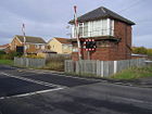
|
Marchey's House Crossing | C403 (Northumberland) | Brock Lane | West Sleekburn | Northumberland | Northumberland | ||

|
C403 (Northumberland) | Brock Lane | West Sleekburn | Northumberland | Northumberland | |||
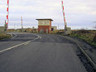
|
Freeman's Crossing | C403 (Northumberland) | Cambois | Northumberland | Northumberland | |||

|
C403 (Northumberland) | Cambois | Northumberland | Northumberland | ||||

|
C403 (Northumberland) | Cambois | Northumberland | Northumberland | ||||
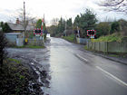
|
Hepscott Crossing | C132 (Northumberland) | Hepscott | Northumberland | Northumberland | |||

|
A1068 | Choppington Road | Choppington | Northumberland | Northumberland | |||
|
Bedlington North Crossing | C404 (Northumberland) | Barrington Road | Bedlington Station | Northumberland | Northumberland | ||

|
Bedlington South Crossing | C405 (Northumberland) | Station Road | Bedlington Station | Northumberland | Northumberland | ||

|
Clifton Crossing | unclassified | Clifton Lane | near Clifton | Northumberland | Northumberland | ||

|
Stannington Crossing | C363 (Northumberland) | Stannington Station Road | Stannington | Northumberland | Northumberland | ||

|
A193 | Front Street | Bebside | Northumberland | Northumberland | |||

|
C410 (Northumberland) | Wharton Street | Newsham, Blyth | Northumberland | Northumberland | track may have been lifted but still shown on OS mapping | ||

|
B1523 | Plessey Road | Newsham, Blyth | Northumberland | Northumberland | track may have been lifted but still shown on OS mapping | ||

|
B1523 | Plessey Road | Newsham, Blyth | Northumberland | Northumberland | |||

|
Newsham South Crossing | A1061 | South Newsham Road | South Newsham, Blyth | Northumberland | Northumberland | ||

|
unclassified | St Michaels Avenue | New Hartley | Northumberland | Northumberland | |||

|
A190 | Station Road | Seghill | Northumberland | Northumberland | |||

|
Holywell Crossing | unclassified | Church Road | Backworth | Northumberland | North Tyneside | ||

|
C367 (Northumberland) | Cramlington | Northumberland | Northumberland | ||||

|
Killingworth Crossing | B1505 | Station Road | Killingworth | Northumberland | North Tyneside | ||

|
Callerton Lane Crossing | C106 (Newcastle upon Tyne) | Callerton Lane | Callerton Parkway Metro Station | Northumberland | Newcastle upon Tyne | Tyne and Wear Metro | |

|
Station Road Crossing | C107 (Newcastle upon Tyne) | Station Road | Kenton Bank Foot | Northumberland | Newcastle upon Tyne | Tyne and Wear Metro | |

|
Brunton Lane Crossing | C101 (Newcastle upon Tyne) | Brunton Lane | Kingston Park | Northumberland | Newcastle upon Tyne | Tyne and Wear Metro | |

|
Fawdon Lane Crossing | C105 (Newcastle upon Tyne) | Fawdon Lane | Fawdon | Northumberland | Newcastle upon Tyne | Tyne and Wear Metro | |

|
Howdon Lane Crossing | unclassified | Howdon Lane | Howdon | Northumberland | North Tyneside | Tyne and Wear Metro | |

|
Longbyre Crossing | unclassified | Longbyre | Northumberland | Northumberland | |||

|
Haydon Bridge Crossing | B6319 | Church Street | Haydon Bridge | Northumberland | Northumberland | ||

|
Warden Crossing | C234 (Northumberland) | Warden | Northumberland | Northumberland | |||

|
Dilston Crossing | B6321 | Dilston, Corbridge | Northumberland | Northumberland | |||

|
Prudhoe Crossing | C255 (Northumberland) | Station Road | Prudhoe | Northumberland | Northumberland | ||

|
Wylam Crossing | C254 (Northumberland) | Station Road | Wylam | Northumberland | Northumberland | ||

|
Clara Vale Crossing | unclassified | Clara Vale | Durham | Gateshead | |||

|
Addison Crossing | unclassified | Haugh Lane | Stella | Durham | Gateshead | ||

|
Boldon Crossing | B1298 | Boldon Lane | East Boldon | Durham | South Tyneside | ||

|
Tile Sheds Crossing | unclassified | Tile Shed Lane | East Boldon | Durham | South Tyneside | ||

|
Moody Crossing | B1299 | Station Road | East Boldon | Durham | South Tyneside | ||

|
Hall Dene Crossing | unclassified | Lord Byron's Walk | Seaham | Durham | Durham | ||

|
Hett Mill Crossing | unclassified | Hett Mill Lane | Hett | Durham | Durham | ||

|
unclassified | Victoria Terrace | Hartlepool | Durham | Hartlepool | |||

|
unclassified | Marsh House Lane | Greatham | Durham | Hartlepool | |||

|
Cowpen Lane Crossing | C148 (Stockton-on-Tees) | Wolviston Back Lane | Cowpen Bewley | Durham | Stockton-on-Tees | ||

|
Billingham Crossing | unclassified | Station Road | Billingham | Durham | Stockton-on-Tees | ||

|
Norton on Tees Crossing | unclassified | Calf Fallow Lane | Norton on Tees | Durham | Stockton-on-Tees | ||

|
Norton West Crossing | unclassified | Blakeston Lane | Roseworth | Durham | Stockton-on-Tees | ||

|
B6278 | Stanhope | Durham | Durham | Weardale Railway (heritage line) | |||

|
Low Lane | Witton-le-Wear | Durham | Durham | Weardale Railway (heritage line) | |||

|
Heighington Crossing | B6444 | Heighington Lane | Heighington Station, near Newton Aycliffe | Durham | Durham | ||

|
unclassified | Coatham Lane | Coatham Mundeville | Durham | Darlington | |||

|
C138 (Stockton-on-Tees) | Durham Lane | Allens West Station, Eaglescliffe | Durham | Stockton-on-Tees | |||

|
C139 (Stockton-on-Tees) | Urlay Nook Road | Urlay Nook | Durham | Stockton-on-Tees |
| Level Crossing | ||||||||
| ||||||||
|


