List of Level Crossings in the North West
Jump to navigation
Jump to search
Below is a list of level crossings in the North West of England.
This list is incomplete; you can help by expanding it.
| Image | Name | Number | Road Name | Location | County | Authority | Map | Notes |
|---|---|---|---|---|---|---|---|---|
|
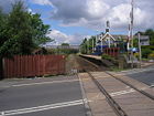
Brierfield Station | B6248 | Railway Street | Nelson | Lancashire | Lancashire | ||
|
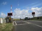
unclassified | Gilsland | Cumberland | Cumberland | Automatic half barrier crossing (AHB) | |||

|
unclassified | Upper Denton | Cumberland | Cumberland | Manually controlled gate crossing (MCG) | |||
|
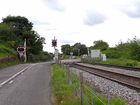
unclassified | Upper Denton | Cumberland | Cumberland | Automatic half barrier crossing (AHB) | |||
|
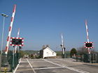
unclassified | Low Row | Cumberland | Cumberland | CCTV monitored manually controlled barrier crossing (MCB) | |||
|
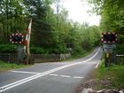
Naworth Crossing | unclassified | Brampton | Cumberland | Cumberland | Automatic half barrier crossing (AHB) | ||

|
Milton Crossing | A689 | Brampton | Cumberland | Cumberland | Locally monitored manually controlled barrier crossing (MCB) | ||
|
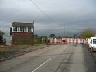
Brampton Fell Crossing | B6413 | Brampton | Cumberland | Cumberland | Manually controlled gate crossing (MCG) | ||
|
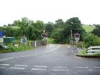
unclassified | How | Cumberland | Cumberland | Automatic half barrier crossing (AHB) | |||

|
Broadwath Crossing | unclassified | Heads Nook | Cumberland | Cumberland | Automatic half barrier crossing (AHB) | ||

|
unclassified | Wetheral | Cumberland | Cumberland | Locally monitored manually controlled barrier crossing (MCB) | |||

|
unclassified | Todhills | Cumberland | Cumberland | CCTV monitored manually controlled barrier crossing (MCB) | |||

|
Low House Crossing | unclassified | Hornsby | Cumberland | Cumberland | Locally monitored manually controlled barrier crossing (MCB) | ||

|
Culgaith Crossing | B6412 | Station Road | Culgaith | Cumberland | Westmorland and Furness | Locally monitored manually controlled barrier crossing (MCB) | |

|
St Bees Crossing | B5345 | Main Street | St Bees | Cumberland | Cumberland | Locally monitored manually controlled barrier crossing (MCB) | |

|
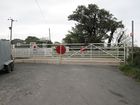
Drigg Crossing | unclassified | Shore Road | Drigg | Cumberland | Cumberland | Manually controlled gate crossing (MCG) | |
|
unclassified | Saltcoats | Cumberland | Cumberland | Manually controlled gate crossing (MCG) | |||

|
Bootle Crossing | unclassified | Bootle | Cumberland | Cumberland | Manually controlled gate crossing (MCG) | ||
|
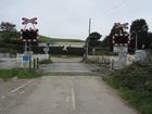
Whitback Crossing | unclassified | Whitbeck | Cumberland | Cumberland | Automatic open crossing (AOCL) | ||
|
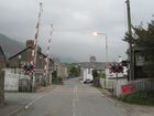
Silecroft Crossing | unclassified | Main Street | Silecroft | Cumberland | Cumberland | Locally monitored manually controlled barrier crossing (MCB) | |

|
Kirksanton | A5093 | Kirksanton | Cumberland | Cumberland | Manually controlled gate crossing (MCG) | ||

|
Kirksanton Crossing | A5093 | Kirksanton | Cumberland | Cumberland | Manually controlled gate crossing (MCG) | ||
|
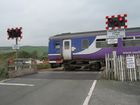
Haverigg Crossing | unclassified | Millom | Cumberland | Cumberland | Automatic half barrier crossing (AHB) | ||
|
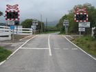
Green Road Crossing | unclassified | Millom | Cumberland | Cumberland | Automatic open crossing (AOCL) | ||
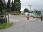
|
unclassified | Foxfield | Lancashire | Westmorland and Furness | Manually controlled gate crossing (MCG) | |||
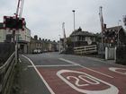
|
Askam Crossing | unclassified | Ireleth Road | Askam in Furness | Lancashire | Westmorland and Furness | Locally monitored manually controlled barrier crossing (MCB) | |
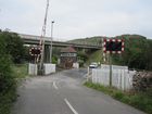
|
Park South Crossing | unclassified | St Helens | Dalton-in-Furness | Lancashire | Westmorland and Furness | Locally monitored manually controlled barrier crossing (MCB) | |
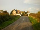
|
Wraysholme Crossing | unclassified | Wraysholne Lane | Flookburgh | Lancashire | Westmorland and Furness | Automatic open crossing (AOCL) | |
|
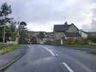
unclassified | Black Dyke Road | Arnside | Lancashire | Westmorland and Furness | Automatic half barrier crossing (AHB) | ||
|
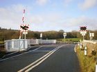
unclassified | New Road | Silverdale | Lancashire | Westmorland and Furness | Automatic half barrier crossing (AHB) | ||
|
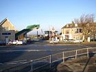
unclassified | Hest Bank | Lancashire | Lancashire | ||||
|
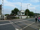
B5275 | Bare Lane | Morecambe | Lancashire | Lancashire | |||

|
Carleton Level Crossing | B5268 | Blackpool Road | Carleton | Lancashire | Lancashire | ||

|
B5259 | Lytham Road | Moss Side | Lancashire | Lancashire | |||

|
unclassified | Portland Street | Southport | Lancashire | Sefton | |||

|
unclassified | Duke Street | Southport | Lancashire | Sefton | |||

|
B5208 | Aughton Road | Southport | Lancashire | Sefton | |||

|
unclassified | Liverpool Road | Southport | Lancashire | Sefton | |||

|
unclassified | Grosvenor Road | Southport | Lancashire | Sefton | |||

|
unclassified | Victoria Road | Formby | Lancashire | Sefton | |||

|
unclassified | New Lane | Martin Hall | Lancashire | Lancashire | |||

|
unclassified | Hall Road West / Hall Road East | Crosby | Lancashire | Sefton | |||

|
unclassified | Brooke Road West / Brooke Road East | Crosby | Lancashire | Sefton | |||

|
unclassified | St Johns Road | Crosby | Lancashire | Sefton | |||

|
unclassified | Melling Lane | Maghull | Lancashire | Sefton |
| Level Crossing | ||||||||
| ||||||||
|


