Star.pngStar grey.pngStar grey.pngStar grey.pngStar grey.png

Stretton Baskerville

From Roader's Digest: The SABRE Wiki
(Redirected from M69 J1)
Jump to navigation Jump to search
Stretton Baskerville
Location Map ( geo)
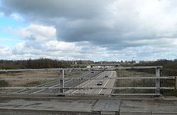
M42 at its junction with the A5 - Geograph - 1785316.jpg
Cameraicon.png No pictures uploaded (Upload?)
Location
Leicester Grange
County
Leicestershire • Warwickshire
Highway Authority
National Highways
Junction Type
Roundabout Interchange
Roads Joined
M69, A5, B4109
Junctions related to the B4109

Stretton Baskerville is junction 1 of the M69.

Routes

Route To Notes

M69

(M1 North), Leicester

M69

Birmingham (M6), Coventry

A5

Tamworth, Nuneaton 4.6m/15'0" height limit in 2 miles

A5

(M1 South) Milton Keynes, Lutterworth

B4109

Hinckley, Burbage

B4109

Wolvey


Stretton Baskerville
Junctions on the M69
M6 (2) Ansty  • 1 Stretton Baskerville  • 2 Hinckley  • 3 Whetstone
Junctions on the A5
London - CrickMarble Arch • Marylebone Flyover • Staples Corner • Canons Corner • Brockley • Elstree Crossroads • Park Street • King Harry • Peahen Crossroads • Friars Wash • Dunstable Crossroads • Chalk Hill Rdbt • M1 Junction 11A • Thorn Rdbt • Hockliffe Crossroads • Sheeps Lane Rdbt • Little Brickhill • Caldecotte • Redmoor • Portway • Abbey Hill • Old Stratford Rdbt • Tove Rdbt • Weedon Crossroads • Watford Crossroads • Kilsby • Halfway House Rdbt • DIRFT Rugby North Rdbt
Crick - TamworthCrick • DIRFT Rugby East Rdbt • DIRFT Rugby North Rdbt • Gibbet Rdbt • Cross in Hand • High Cross • Smockington Hollow • Stretton Baskerville • Sketchley Rdbt • Dodwells Rdbt • Longshoot • Higham Rdbt • Red Gate • Mancetter Rdbt • Holly Lane Rdbt • Grendon Rdbt • Dordon Rdbt • M42 Junction 10
Tamworth-TelfordM42 Junction 10 • Centurion • Glascote • Ventura Park • Mile Oak • Weeford • Wall Island • Muckley Corner • Rising Sun • The Turf • Churchbridge • Wynn's Corner • Longford Island • Gailey Interchange • Gailey Island • Pickmere Roundabout • Limekiln Bank Rdbt • Priorslee Rdbt • Priorslee Interchange • Hollinswood
Telford-OswestryHollinswood • Forge • Cluddley • Preston Island • Emstrey Island • Bayston Hill Rdbt • Edgebold Rdbt • Woodcote Rdbt • Churncote Rdbt • Felton Butler Rdbt • Wolfshead Rdbt • Queens Head Junction
Oswestry-HolyheadQueens Head Junction • Mile End Rdbt • Whittington Rdbt • Five Crosses • Gledrid Rdbt • Halton Rdbt • Whitehurst Rdbt • Llys y Gwynt • Antelope Rdbt • Anglesey Arms • Carreg Bran • Glan Menai • Nant Turnpike • Dalar Hir • Caergeiliog


SABRE - The Society for All British and Irish Road Enthusiasts
Discuss - Digest - Discover - Help