Ray Hall
| Ray Hall | |||
| Location Map ( geo) | |||
 | |||
| |||
| Location | |||
| West Bromwich | |||
| County | |||
| Staffordshire | |||
| Highway Authority | |||
| National Highways | |||
| Junction Type | |||
| non-Directional-T | |||
| Roads Joined | |||
| M5, M6 | |||
Ray Hall interchange, is a freeflow omnidirectional interchange set in an area of 150 acres and is one of the most congested interchanges on the UK motorway network. It is the northern terminus of the M5 and junction 8 of the M6. It is located between Birmingham and Wolverhampton in a densely populated area.
The reason why this junction is so congested is because the M6 North carries all traffic from Birmingham around the local area and long distance traffic from London to the North-West. It meets the M5 and almost all of the M5's traffic heads north on the M6. The congestion is caused where the two roads meet because the M6 is D3M heading north approaching the junction and still D3M afterwards. Combined with the M5's D2M, five lanes attempt to merge into three, which means that congestion starts at the M5 junction 1 and M6 junction 7 at most times of the day.
However, for drivers heading south, this junction is a lot less congested, and comes as a relief to many after heading through the congested M6 between 10a and 9. It is also plain sailing for those heading from M5 north to M6 south and vice versa, because this movement is performed less frequently.
Routes
| Route | To | Notes |
| The SOUTH WEST, Birmingham (W & S), West Bromwich | ||
| The NORTH WEST, Walsall, Wolverhampton | ||
| London (M1 & M40), Birmingham (N,E & Cen.), N.E.C. & Airport |
Strip Maps
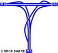
The current layout of the interchange.

History
The first part of the interchange to open was the M5 south to M6 North west when the motorway from M5 J3 Quinton to M6 J9 Bescot was opened on 15 May 1970 by Fred Mulley, Minister of Transport. This completed the north - south section of the Midland Links motorway.
The M6 East (from J7 Great Barr) to M6 North west link and the M5 south to M6 East link opened on 20 July 1970 to fully open the interchange.


