OS Map Symbols/Roads
Originally roads were simply depicted by two pararllel lines, with one slightly heavier than the other. If the road is not fenced, then the line is dashed. Later, when colour was introduced, roads were coloured according to standard, so the best roads were Red, average roads a yellow-orange, and poor or narrow roads left white. These colours have survived to the present, with red commonly used for A roads, orange or brown for B roads, Yellow for unclassified and white for urban streets and country lanes. When Motorways were built they were initially coloured red, but quickly changed to blue, using a similar shade to the signage, to help differentiate these new routes. More recently, green has been introduced for primary routes, again matching the signage colour.
Work in Progress The below titles hopefully align with the current key on Landrangers, but I don't have one in front of me...
Motorways
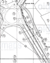
When motorways were first introduced, the OS didn't really know how to show them, and so they used the same red as A roads. However, in order to better differentiate them this was subsequently changed to blue, a similar shade to the actual signage, with solid black outline. Unlike dual carriageways, the central reservation has never been depicted at 1:50,000 scale. However, this is not true on the 1:25,000 maps, where a dashed centre line is shown, and slip roads are also more clearly segregated at larger interchanges.
Junction Numbers
At first, junction numbers were not included. However, as the motorway network grew, the new 1:50,000 sheets did show the numbers, and the now familiar blue squares with white numbers were introduced, set to one side of the junction to avoid hiding detail. Small scale maps often use white on black, or black on white to indicate whether the junction is full or limited access, rather than trying to show all of the slip roads.
Services
Service areas are shown on the 1:50,000 maps with white circles around a Black 'S' across the carriageways. This symbol can also be used on one side or the other, to show services only accessible from one side of the motorway, or indeed appropriately positioned when the services are accessed at a junction. On smaller scale maps, black triangles are used to show which side of the motorway the services are on, normally therefore forming a diamond. A White S is placed in the centre of the symbol, whether triangle or diamond. These symbols are also increasingly being applied to A road services, although the requirements are not clear.
Primary Routes
Up until c2002, there was no differentiation on Landranger maps between primary and non primary routes. However, since then green, a similar shade to the signage, has been introduced to make primary routes easier to identify. Smaller scale maps had been doing this for many years, partly in response to the differentiation used in road atlases. Explorer maps still don't show the difference.
Main / A roads
The origins of using red for A roads dates back before the roads were classified in 1922. The OS One Inch Popular edition used red, a shade closer to scarlet than the current colour, to show main roads. Other mapping also used red, and there were a variety of terms used to describe these roads in the key, whether 'Main Roads', Good Roads' or 'First Class'. After the classification of routes, the OS were slow to add route numbers to the mapping, but they do seem to have updated the maps to remove discrepancies between their erstwhile main roads and the new network of A class routes, so by the time road numbers were fully added, the colouration of the map was already complete.
As the One Inch series progressed to the 7th series, the shade of red hardly changed. The irregularities of printing, and the age of these maps mean that some appear to use a darker red than others, but it is doubtful that this was intentional. However, in the 1970s the new 1:50,000 series maps arrived, and one of the most obvious changes was the moved to a pinky red, not far from the Magenta used in printers, or indeed the new colour of the front covers.
Early 1:25,000 maps used a single orange colour to depict all roads, with A roads being solid orange. They now use the same pinky-red as Landrangers, although with no differentiation between Primary and non primary routes.
Secondary / B roads
On the first coloured editions of the One inch maps, all roads not coloured red where either an orangey yellow or white. The 'Second Class' roads were differentiated from 'third class' by different widths of lines. However, as many of the routes which became B roads were then coloured red, this distinction was probably sufficient at the time. However, as the red coloured roads became aligned with the new A road network, it increased, in places significantly, the number of yellow roads shown. As a result, a Brown colour was selected to show B roads separately for the 7th series maps, and at the same time the orangey-yellow was changed to yellow for other routes. Again, the precise shade varies from a light orangey brown to a darker shade. The introduction of the 1:50,000 series maps saw the colour change once more, moving back to an orange colour, although darker than the original orangey-yellow.
Early 1:25,000 maps used a single orange colour to depict all roads, with the B roads using a long orange and short white dash. On very short, often urban, routes, and those often interrupted by junctions it can prove very difficult to identify if a roads is B or not. Modern explorer maps use the same orange as Landrangers.
Other roads
Originally termed 'second' or 'third' class roads, they included many B roads, and indeed some A roads in more rural areas. The colour was the orangey-yellow as described above, but it was not until the separation of B roads for the seventh series that real clarification came on the maps. As this point, the colour was turned to yellow, as it remains to this day, but the two widths of line remained to indicate the wider and narrower routes. This is often averaged out, and certainly short narrow sections are rarely clearly shown, although some roads do change from wide to narrow at seemingly random places.
The mapping symbol remained constant on the 1:50,000 and Landranger maps, although the key now carries the clarification that the width of the road is generally greater than or less than 4m. This roughly equates to two way (S2) or single track. Generally speaking, although by no means absolutely accurate, if the modern Landranger maps show a road in yellow it is open to the public, and suitable for motorised traffic. There are some notable discrepancies however, and not just confined to rural areas.
Early 1:25,000 maps used a single orange colour to depict all roads, with unclassified roads having equal white-orange dashes, and the road width shown fairly clearly. They now differentiate between routes over and under 4m, as do Landranger maps, the main difference being that the wider routes use an orangey-yellow similar to that used by the early one-inch maps, whilst the narrower roads are just yellow.
Other road, drive or track
With modern Landranger maps continuing to show ever route conceivably passable by a motorised vehicle, much as the earliest 1 inch maps did (although back then it was horse and cart), white is used as a catch all for other routes that are passable. However, it does not by any means indicate that the public has a right to do so. In urban areas, white is used to show the maze of side streets, housing estate cul-de-sacs and back lanes. However, old roads which have been stopped up and converted to cycle routes are sometimes still depicted in this manner, as are the wide paths through parks and private roads in industrial estates.
In rural areas, white routes are more likely to indicate a private, unpaved track, or the driveway to a farm or country house. It is safer to assume that such routes are not accessible to cars unless there are clear indications on the ground to the contrary. In England and Wales, many of these tracks are supplemented with a right of way symbol, showing that the public can walk, cycle or ride a horse along the route. In Scotland the laws are different, and there is a general presumption that the public can walk or ride any track unless it is explicitly indicated to the contrary.
Road Types and Features
Fenced
The OS use a dashed black line to show that a road is unfenced, and a solid black line to show it is fenced (or walled, otherwise constrained). The lines can be different on each side of the road, showing that one side is fenced and the other open. Unfenced roads are normally found in moorland areas, but the symbol is also used (usually on white roads) where roads pass through parks. Forest roads are almost always dashed on both sides.
Dual Carriageway
The one inch maps used thicker black lines on each side of the road to indicate that a road was dualled. It is known that this was not always used for B roads. As noted above, motorways were shown in the same manner. With the introduction of the 1:50,000 maps, the clarity of a dual carriageway was improved, by making the coloured line wider, and introducing a central black line to show the central reservation. This is broken where a central reservation gap exists for a junction. As Motorways are almost always dualled, and don't have gaps, the old type symbol remained, with a new, blue, colour.
The 1:25,000 maps introduced the central reservation line earlier than the smaller scale maps, again with gaps as appropriate at junctions. They have since introduced further clarity, with dashed or solid centre lines, although this does not indicate the presence of a central barrier. The scale of the map also allows white space to be introduced where the carriageways are split a little further apart. Motorways are shown in the same manner.
Single Track
All scales of OS mapping now identify single track roads when they are classified. If unclassified, the differentiation is generally dealt with as noted above (ie greater than or less than 4m in width). The maps show single track roads with dashed white/colour lines, small scale maps having equal dashes, whilst Landranger and Explorer used long colour-short white lines.
Under Construction
A roads and motorways under construction are shown with unbounded dashed lines.
Steep Hills
Arrows or chevrons are used to indicate steep hills, the point of the arrow pointing down the hill. The steepest hills get double arrows, resembling the Citroen badge! The current Landranger and Explorer maps show 1:5 (20%) to 1:7 (14%) with a single arrow, and steeper climbs with a double arrow.
Road Structures
Roads also feature numerous bridges, tunnels, cuttings and embankments amongst other structures, each with their own symbol.
| OS Mapping | ||||||||
| ||||||||
|


