Oldbury Interchange
| Oldbury Interchange | |||
| Location Map ( geo) | |||
 | |||
| |||
| Location | |||
| Langley | |||
| County | |||
| Worcestershire | |||
| Highway Authority | |||
| National Highways | |||
| Junction Type | |||
| Roundabout Interchange | |||
| Roads Joined | |||
| M5, A4123 | |||
| Junctions related to the A4123 | |||
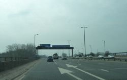
Oldbury Interchange is junction 2 of the M5. It links to Birchley Island.
History
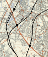
The inner line of the M5 through the West Midlands conurbation was first proposed in the late 1940s and was to take the natural line between Junctions 1 and 3. By 1950 the route was established and the junction with the A4123 was to be located just to the west of Brandhall Road. However this route suffered the major problem of running through the residential area between Oldbury and Smethwick which the councils for these two towns objected to and plans for this section of the motorway were dropped in 1951. This then created the potential for a gap between J1 and J2 forcing traffic to use local roads which caused yet more objections from the two councils.
It's not clear what happened in the intervening years but by 1959 an alternative route was found which was to place the motorway above the railway line running between Causeway Green and Smethwick West. Railway lines form a natural boundary to development so community severance would be kept to a minimum, or so the theory goes. Initial plans were for a D2M viaduct running above the railway but it was soon realised that the viaduct would be much wider than the railway and land outside the railway boundary would be required. To overcome this the design was changed to a double deck viaduct which kept everything within the railway boundary. A standard roundabout interchange is shown on plans for the single level viaduct but it's not clear how the slip roads would work for the upper tier of the double deck option, and in particular the length required to gain height from the A4123 which is below the level of the railway and three storeys below the top deck of the M5.
By 1962 the railway viaduct was proving problematic so another line was investigated which was to move the M5 even further to the west. This would be elevated above a canal which follows an industrial area so community opposition would be minimised. The junction would no longer be on the A4123 but at a separate roundabout with a short link to the A4123/A4034 junction. This scheme was eventually built in 1970.
The trouble in finding a suitable route for this section of the M5 explains why junction 2 lies on the edge of a long kink in the motorway.
Routes
| Route | To | Notes |
| The NORTH WEST, N.E.C & Airport (M6) | ||
| The SOUTH WEST, London, Worcester, (M42, M40) | ||
| Birmingham, Dudley, Wolverhampton, Sandwell (A4034) | ||
| leads to Superstore and Fire Station |
| Oldbury Interchange | ||
| ||
|


