Star.pngStar grey.pngStar grey.pngStar grey.pngStar grey.png

SABRE Maps/Co-ordinate Finder

From Roader's Digest: The SABRE Wiki
Jump to navigation Jump to search
SABRE Maps
In-depth guide
SABRE Maps Grid calibrator.JPG
Cameraicon.png Pictures related to SABRE Maps
View gallery (46)
Quick Links
Start Here
Copyright • Stitching scans • Georeferencing maps in-depth • Creating map tiles
Related Terms
SABRE Maps
SABRE Maps coverage • Map layer names • Co-ordinate Finder • Sheetfinder • Online Grid Calibrator

The SABRE Maps Co-ordinate Finder is a sub-project of SABRE Maps.

The Co-ordinate Finder grew out of a need for identifying the co-ordinates of any particular location within Great Britain and Ireland in order to be able to more easily bring historic mapping to SABRE Maps.

Whilst there are a number of other applications on the Internet that provide similar functionality for modern co-ordinate systems such as WGS84 Latitute/Longitude, the OSGB National Grid and the Irish Grid; the SABRE Maps Co-ordinate Finder is unique in also displaying a large number of archaic formats historically used for mapping of these islands such as the OS National Yard Grid and the Cassini (Delamere) projection.

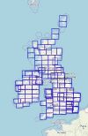
It can also show the sheet boundaries of a number of OS, OSI and OSNI map series, which is both useful in terms of simply discovering a map's location; and also within the various SABRE Maps back-end processes such as georeferencing historic mapping and creating the indexing for the SABRE Maps Sheetfinder.

Using the Co-ordinate Finder

The SABRE Maps Co-ordinate Finder

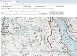
The basic map behind the Co-ordinate Finder is a simple OpenStreetMap base, but the location of the mouse cursor on the map is also displayed in various co-ordinate systems to the bottom left of the window. These co-ordinates are automatically recalculated as the mouse cursor moves to the new location.

In addition to this, if a user clicks on a map point, then a small window will appear with a subset of the co-ordinates of the point selected. These co-ordinates can be selected and copied for use in other applications.

Available co-ordinate systems

The following co-ordinate systems are currently available within the Co-ordinate Finder:

Modern Ordnance Survey Great Britain

  • National Grid Reference (10 figures)
  • National Grid Co-ordinate

Modern Ordnance Survey Ireland and OS Northern Ireland

  • Irish Grid Reference (10 figures)
  • Irish Grid Co-ordinate
  • Irish Transverse Mercator Grid

Archaic Ordnance Survey Great Britain

  • National Yard Grid Co-ordinate
  • Cassini (Delamere)
  • Bonne (Scotland)
  • Cassini (War Office) Grid
  • Cassini (War Office) Co-ordinates

Archaic Ordnance Survey Ireland and OS Northern Ireland

  • Bonne (Ireland)
  • War Office Irish Grid
  • War Office Irish Co-ordinates

Other co-ordinate systems

  • WGS84 Lat/Lon
  • OSGB36 Lat/Lon
  • ED50 Lat/Lon
  • ED50/UTM Zone 29N Co-ordinates
  • ED50/UTM Zone 30N Co-ordinates
  • ED50/UTM Zone 31N Co-ordinates
  • what3words

Note that the Cassini (Delamere) and the two Bonne projection co-ordinates are shown in miles rather than the more commonly found feet, as the SABRE Maps tile creation tools require the values in miles.

Map series boundary overlays

Thanks to the agreement of The Charles Close Society, the original creators of the data, the SABRE Maps Co-ordinate Finder also has held within it the outlines of the most common relevant OS, OSI and OSNI sheets in order to be able to quickly locate the locations of each map. This sheet information can be accessed from the menu in the top right hand corner of the Finder.

The mapping series available include the following:

OSGB map series

One Inch

  • One Inch Popular
  • One Inch Fifth Edition
  • One Inch New Popular Edition
  • One Inch Seventh Series

Half Inch

  • Half Inch Large Sheet
  • Ministry of Transport Road Map
  • Half Inch Second Series
  • Half Inch National Yard Grid maps

Quarter Inch and 1:250k

  • Third Edition
  • Fourth Edition
  • Fifth Series
  • 1:250k Colour Raster

Other scales

  • Landranger
  • 1:25k Provisional Edition
  • Miniscale
  • Tourist
  • VectorMap District
  • OpenMap Local

OSI / OSNI map series

  • OSI One Inch (1st, 2nd and 3rd Series)
  • OSNI One Inch Popular Edition (partial coverage)
  • OSNI One Inch (3rd Edition)
  • OSI Half Inch
  • OSNI Half Inch (2nd Series)
  • OSI 1:250,000
  • OSNI Quarter Inch Second Series
  • OSNI Discoverer
  • OSI Discovery

Credits

The SABRE Maps Co-ordinate finder tool uses the Co-ordinate converter developed by Ed Fielden for Fielden Maps; whilst the Sheetlines vector files are by courtesy of and agreement with The Charles Close Society.

Links


SABRE Maps
Miscellaneous
SABRE Maps • SABRE Maps/Layer names • SABRE Maps/Online Grid Calibrator • SABRE Maps/Sheetfinder • SABRE Maps/25k First Series coverage project • SABRE Maps/Adding a map • SABRE Maps/Calibrating • SABRE Maps/Coverage projects • SABRE Maps/Creating map tiles • SABRE Maps/Fifth Edition coverage project • SABRE Maps/Half Inch coverage project • SABRE Maps/Landranger coverage project • SABRE Maps/MOT coverage project • SABRE Maps/New Popular Edition coverage project • SABRE Maps/OS Copyright • SABRE Maps/OSNI One Inch • SABRE Maps/Popular Edition coverage project • SABRE Maps/Quarter Inch coverage project • SABRE Maps/Scottish Popular Edition coverage project • SABRE Maps/Seventh Series coverage project • SABRE Maps/Ten Mile Road Map coverage project • SABRE Maps/Tracing
Related Pictures
View gallery (46)
SABRE Maps demo 2.png5th revision code - early.JPGSheetfinder map outlines.jpgSABRE-Maps-Grid-Calibrator-Archaic.jpgSABRE-Maps-Grid-Calibrator-Disguised-Virtual-Edges.jpg
Road Mapping
Ordnance SurveyMoT Maps • Ten Mile Road Map • Route Planning Map • One Inch(Popular Edition) • 1934 London PT • Landranger • Half Inch • Quarter Inch • Routemaster • Travelmaster • Road Map • Travel Map • Pathfinder • Explorer  • Outdoor Leisure • Tourist • Ten Mile • City Link • City, Town and Neighbourhood • Miniscale • OS Great Britain
Ordnance Survey Northern IrelandRoad Map • One Inch • Discoverer
Ordnance Survey IrelandDiscovery • Half Inch
Other MappingA-Z • AA • Bartholomew • Book of the Road • Google • Michelin • Philips • Others
Road Basics
Physical layoutSingle track • Single carriageway • Dual carriageway • High Quality Dual Carriageway • Road Widths • Urban Streets • Abandoned Road
Legal typesAll-purpose Road • Special Road • Motorway • Trunk road • Principal road • Classified Numbered road • Classified Unnumbered Road • Unclassified road • Primary Route • Non Primary Route • Right of Way • Unadopted road
Road numbers1922 Road Lists • Classification • Defunct road • Euroroutes • MoT Maps • National Cycle Network • Numbering principles • Numbering anomalies • Disputed Numbers • Recycled number • Unallocated numbers • Fictional Road Numbers • Junction numbers • Essential Traffic Routes
Road FeaturesArterial Road • Automatic Bollard • Balancing Pond • Belisha Beacon • Bott's Dots • Bypass • Cannon • Cats' Eyes • Cattle Grid • CD Lanes • Central Reservation • Chopsticks • Crash Barrier • Cuttings and Embankments • Cycle Lane • Emergency Phone • Escape lane • Expressway • Fingerpost • Flare • Ford • Gore • Green Bridge • Green Wave • Hairpin bend • Hard shoulder • Island • Junction • Layby • Level Crossing • Local Access Road • Managed Motorways • Milestone • Multi Lane Drop • Multiplex • No-Car Lane • Nose • Oxbow Road • Parapet • Petrol station • Play Street • Raised Pavement Markers • Ramp Metering • Retaining Wall • Road Studs • Roadside Art • Roadside Quarry • Roadworks • Secret motorway • Signage • Smart Motorway • Snow pole • Speed Limit • Spur • Street Lighting • Surface Dressing • Temporary terminus • Throughpass • Tidal Flow • Tiger tail • Toll booth • Traffic cone • Traffic Signals • Tunnel • Vehicle Recovery • Walking and Cycling Friendly Road • Weaving • Wig-Wag Signals • Winter Maintenance • Zip merge
Traffic CalmingBuild-Outs • Chicane • Dragon's Teeth • Home Zone • Low Traffic Neighbourhood • Pinch Point • Quiet Lane • Rumble strips • Safety Cameras • Sleeping Policeman • Speed bump
Public Transport FeaturesBus Lane • Bus stop • Guided Busway • Park and Ride • Tramway • Trolleybus System
Other termsAnderson report • Guildford Rules • Highway Authority • Highway Code • Model Traffic Area • Motorway alphabet • Pre-Worboys • Primary Destinations • Roads by 10 • Transport alphabet • Worboys report
AcronymsAADT • ADS • ANPR • ATM • DfT • GSJ • HA • HATO • HE • HETO • HQDC • LAR • LILO • LTN • MOVA • NCN • NMU • NRA • PBU • POPE • PTS • PFI • RCS • SABRE • SCOOT • SSD • SON • SOX • SRN • TEN-T • TERN • TfL • TII • TOTSO • TRO • TSM • TSRGD • UTC • VAS • VMS • VSL


SABRE - The Society for All British and Irish Road Enthusiasts
Discuss - Digest - Discover - Help