Star.pngStar grey.pngStar grey.pngStar grey.pngStar grey.png

SABRE Maps/Sheetfinder

From Roader's Digest: The SABRE Wiki
Jump to navigation Jump to search
SABRE Maps
In-depth guide
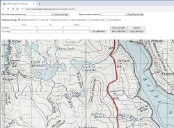
SABRE Maps Grid calibrator.JPG
Cameraicon.png Pictures related to SABRE Maps
View gallery (46)
Quick Links
Start Here
Copyright • Stitching scans • Georeferencing maps in-depth • Creating map tiles
Related Terms
SABRE Maps
SABRE Maps coverage • Map layer names • Co-ordinate Finder • Sheetfinder • Online Grid Calibrator
TSRGD 7001.jpg
The SABRE Maps Sheetfinder is currently considered to be in an uncompleted state.
Not all available maps can yet be accessed via the Sheetfinder. Work is continuing to add more over time.

The SABRE Maps Sheetfinder is a sub-project of SABRE Maps, and is an alternative front-end showing overlays of all available maps on SABRE Maps at each scale.

It was borne from the realisation that with the sheer number of individual map sheets available on SABRE Maps, users were not able to find all available maps of their area of interest. This is rectified with the Sheetfinder, where a user can click on any location on a map of Great Britain and Ireland, and be presented with a list of all sheets of the selected scale available on SABRE Maps of that location.

Using the Sheetfinder

Map sheet example, taken from the Half Inch and Ministry of Transport maps layer
After clicking on a location in the central map, available maps at that scale are displayed on the right hand side

Upon opening the SABRE Maps Sheetfinder, users are greeted with an OpenStreetMap base map, centred on Great Britain and Ireland, with areas to the left and right.

Left menu area

Within the left hand area, controls are located to select a particular map scale that a user is interested in. These are grouped together in appropriate like-scaled sets, so for example, Quarter Inch and 1:250,000 maps are grouped together in a single section. As the user selects a different scale, different coloured overlays appear on the central map. Each coloured shape represents a single map sheet, so where map sheets have overlaps, they are shown correctly as being overlapping.

Also within the left hand area is a search box. Please note that this search is a worldwide one, and so care needs to be taken to select the correct location. Typing in a location, then selecting it will zoom the centred map into that location.

Central map area

The largest part of the Sheetfinder window is the central area containing the main map interface. This map can be moved, scrolled, and zoomed in and out in order to put any location at the centre of the map.

When the user wishes to view maps of a location available on SABRE Maps, they click on that location. If there is at least one map available of that location at the selected scale, it is displayed within the right hand results area.

Right results area

Once a user has clicked on a location, all maps available at that scale of that location are then displayed within the results area on the right hand side of the Sheetfinder window.

These results are sorted by series, sheet and then individual revision by age; with some information about each map and a small thumbnail. By clicking on either the thumbnail or the highlighted map name, a user is then taken to the centre of that map within SABRE Maps.

Clicking on a further location on the central map will update the results area to show that location.


Credits

The Sheetlines sheet outline files are by courtesy of and agreement with The Charles Close Society; whilst the underlying code base is courtesy of the National Library of Scotland.

Links


SABRE Maps
Miscellaneous
SABRE Maps • SABRE Maps/Co-ordinate Finder • SABRE Maps/Layer names • SABRE Maps/Online Grid Calibrator • SABRE Maps/25k First Series coverage project • SABRE Maps/Adding a map • SABRE Maps/Calibrating • SABRE Maps/Coverage projects • SABRE Maps/Creating map tiles • SABRE Maps/Fifth Edition coverage project • SABRE Maps/Half Inch coverage project • SABRE Maps/Landranger coverage project • SABRE Maps/MOT coverage project • SABRE Maps/New Popular Edition coverage project • SABRE Maps/OS Copyright • SABRE Maps/OSNI One Inch • SABRE Maps/Popular Edition coverage project • SABRE Maps/Quarter Inch coverage project • SABRE Maps/Scottish Popular Edition coverage project • SABRE Maps/Seventh Series coverage project • SABRE Maps/Ten Mile Road Map coverage project • SABRE Maps/Tracing
Related Pictures
View gallery (46)
Seventh Series revision code - early maps.jpgQI-4th-prewar revision code.PNGOS TenMileRoad Sheet2 1956.pngBritish National Grid Letters and Numbers.pngOnline-calibrator-guide-arrows.JPG
Road Mapping
Ordnance SurveyMoT Maps • Ten Mile Road Map • Route Planning Map • One Inch(Popular Edition) • 1934 London PT • Landranger • Half Inch • Quarter Inch • Routemaster • Travelmaster • Road Map • Travel Map • Pathfinder • Explorer  • Outdoor Leisure • Tourist • Ten Mile • City Link • City, Town and Neighbourhood • Miniscale • OS Great Britain
Ordnance Survey Northern IrelandRoad Map • One Inch • Discoverer
Ordnance Survey IrelandDiscovery • Half Inch
Other MappingA-Z • AA • Bartholomew • Book of the Road • Google • Michelin • Philips • Others
Road Basics
Physical layoutSingle track • Single carriageway • Dual carriageway • High Quality Dual Carriageway • Road Widths • Urban Streets • Abandoned Road
Legal typesAll-purpose Road • Special Road • Motorway • Trunk road • Principal road • Classified Numbered road • Classified Unnumbered Road • Unclassified road • Primary Route • Non Primary Route • Right of Way • Unadopted road
Road numbers1922 Road Lists • Classification • Defunct road • Euroroutes • MoT Maps • National Cycle Network • Numbering principles • Numbering anomalies • Disputed Numbers • Recycled number • Unallocated numbers • Fictional Road Numbers • Junction numbers • Essential Traffic Routes
Road FeaturesArterial Road • Automatic Bollard • Balancing Pond • Belisha Beacon • Bott's Dots • Bypass • Cannon • Cats' Eyes • Cattle Grid • CD Lanes • Central Reservation • Chopsticks • Crash Barrier • Cuttings and Embankments • Cycle Lane • Emergency Phone • Escape lane • Expressway • Fingerpost • Flare • Ford • Gore • Green Bridge • Green Wave • Hairpin bend • Hard shoulder • Island • Junction • Layby • Level Crossing • Local Access Road • Managed Motorways • Milestone • Multi Lane Drop • Multiplex • No-Car Lane • Nose • Oxbow Road • Parapet • Petrol station • Play Street • Raised Pavement Markers • Ramp Metering • Retaining Wall • Road Studs • Roadside Art • Roadside Quarry • Roadworks • Secret motorway • Signage • Smart Motorway • Snow pole • Speed Limit • Spur • Street Lighting • Surface Dressing • Temporary terminus • Throughpass • Tidal Flow • Tiger tail • Toll booth • Traffic cone • Traffic Signals • Tunnel • Vehicle Recovery • Walking and Cycling Friendly Road • Weaving • Wig-Wag Signals • Winter Maintenance • Zip merge
Traffic CalmingBuild-Outs • Chicane • Dragon's Teeth • Home Zone • Low Traffic Neighbourhood • Pinch Point • Quiet Lane • Rumble strips • Safety Cameras • Sleeping Policeman • Speed bump
Public Transport FeaturesBus Lane • Bus stop • Guided Busway • Park and Ride • Tramway • Trolleybus System
Other termsAnderson report • Guildford Rules • Highway Authority • Highway Code • Model Traffic Area • Motorway alphabet • Pre-Worboys • Primary Destinations • Roads by 10 • Transport alphabet • Worboys report
AcronymsAADT • ADS • ANPR • ATM • DfT • GSJ • HA • HATO • HE • HETO • HQDC • LAR • LILO • LTN • MOVA • NCN • NMU • NRA • PBU • POPE • PTS • PFI • RCS • SABRE • SCOOT • SSD • SON • SOX • SRN • TEN-T • TERN • TfL • TII • TOTSO • TRO • TSM • TSRGD • UTC • VAS • VMS • VSL


SABRE - The Society for All British and Irish Road Enthusiasts
Discuss - Digest - Discover - Help