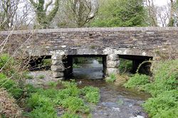
Slaughterbridge
Jump to navigation
Jump to search
| Slaughterbridge | |||
| Location Map ( geo) | |||
 | |||
| |||
| Location | |||
| Slaughterbridge | |||
| County | |||
| Cornwall | |||
| Highway Authority | |||
| Cornwall | |||
| On road(s) | |||
| B3314 | |||
Slaughterbridge crosses the River Camel on the B3314 in the village of the same name . This is the first bridge on a classified road since the river's source. This road runs from Collan's Cross to Wadebridge
| Slaughterbridge | ||
| ||
|
