St Helier Ring Road
| St Helier Ring Road | |||||||||||||||||||||||||
| Location Map ( geo) | |||||||||||||||||||||||||
| |||||||||||||||||||||||||
| From: | Victoria Park | ||||||||||||||||||||||||
| To: | Route de Fort | ||||||||||||||||||||||||
| Highway Authorities | |||||||||||||||||||||||||
| Traditional Counties | |||||||||||||||||||||||||
| Route outline (key) | |||||||||||||||||||||||||
| |||||||||||||||||||||||||
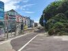
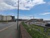
The St Helier Ring Road is a route largely pieced together from existing classified roads around the town, and used to guide traffic around the edges of St Helier, and through a number of one-way systems. Its primary purpose is to guide traffic from the landward side of the island around the town centre and on to the A1 and A17 on the coastal side. This link along the A1 and A17 is not signed as part of the ring road route. The route is better signed and so easier to follow in a clockwise direction, so that will be described first.
Clockwise

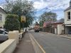
The route starts at the roundabout at Victoria Park on the A1 and heads north east along St Aubin's Road, the B87, It then turns right into Cheapside and left onto the A9, Elizabeth Place. This becomes Rouge Bouillon, and turns right at a roundabout to become the A14. The Ring Road then uses the full length of the A14 as it becomes Springfield Road and leads to the A7. Turning south now, onto St Saviour's Road, the A7 leads rtight into the town centre, but just before reaching the end, ring road traffic has to continue ahead onto the B84, St James' Street.
The route now takes a strange turn, by turning left onto Don Road, the A6, and heading out to Howard Davis Park, where it doubles back on the A3, La Colomberie to be just a few yards from that left turn. Here, although the signage has more or less disappeared, it turns right onto the B84 once more, which quickly becomes the B79, following Green Street down to the roundabout on the A17 at the western end of the Tunnel.
Anticlockwise
If we circle round the roundabout and head north along the B79, it forks left onto Grenville Street, heading into the town centre once more. When it reaches La Colomberie, it turns right onto the former A3 and quickly forks left onto Don Road, the A6. Some people think that the ring road turns left along La Colomberie, and then comes out on the A7, but as neither route is clearly signed, the former seems more likely. The A6 continue ahead and becomes the clockwise route of the ring road, so a left turn onto the B84 along St James' Street is required.
This then becomes the A7 St Saviour's Road. A left turn by the Gas holder leads to the apparently unclassified States Roads of Avenue et Dolmen du Pre des Lumieres, and Rue la Masurier, and then a right turn onto the B74 Stopford Road leads back to the A7. Another one-way loop quickly follows, this time turning left onto the B82 St Mark's Road, and then right onto the apparently unclassified Janvrin Road to reach the A14. Another loop is then required around Le Petit Rue de Val Plaisant and the A8, but after that the ring road is fully two-way back along the A14 and down the A9. However, the western end is another one-way system, this time turning left along The Parade, still the A9, and then right down Gloucester Street to meet the A1 dual carriageway at a signalised junction.
| St Helier Ring Road | ||
| ||
|