U35 (North Ayrshire)
Jump to navigation
Jump to search
| U35 | ||||
| Location Map ( geo) | ||||
 | ||||
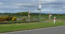
| The south end of the U35 is at this gate at the A78 | ||||
| ||||
| From: | South Pillars (NS199501) | |||
| To: | Hunterston Roundabout (NS201519) | |||
| Via: | Hunterston | |||
| Distance: | 2 miles (3.2 km) | |||
| Meets: | Oilrig Road • Netherton Avenue • Largs Avenue • Castle Avenue • Goldenberry Road • Construction Road • Moory Nooke Road | |||
| Highway Authorities | ||||
| Traditional Counties | ||||
| Route outline (key) | ||||
| ||||
This article is about the Class III road numbered U35 by North Ayrshire Council.
For roads that are numbered U35, see U35.
For roads that are numbered U35, see U35.
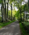
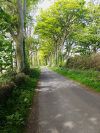
North Ayrshire's U35 road is 2 miles long and goes through the estate of Hunterston. It starts at the South Pillars on the A78 and goes along Highthorn Road, Beech Avenue and Old Road before it gets to the Hunterston Roundabout via Oilrig Road, which is the access road to the Hunterston nuclear power stations from the A78.
The road is mainly an access to the castle at Hunterston but should the A78 be blocked between Hunterston Roundabout and Highthorn the road is used as an emergency contraflow by police. It is also a sign-posted cycle route and bridleway, by-passing the busy A78.
Links
| U35 (North Ayrshire) | ||
|


