Star.pngStar grey.pngStar grey.pngStar grey.pngStar grey.png

Wells Green

From Roader's Digest: The SABRE Wiki
Jump to navigation Jump to search
Wells Green
Location Map ( geo)
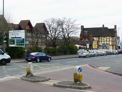
Junction between Old Lode Lane and Hobs Moat Road, Solihull - Geograph - 1770047.jpg
Cameraicon.png View gallery (4)
Location
Sheldon
County
Warwickshire
Highway Authority
Birmingham
Junction Type
Signalised Crossroads
Roads Joined
A45, B425

Wells Green is a junction in the Sheldon District of Eastern Birmingham, with the boundary between Birmingham and Solihull lying just to the east. In years gone by, this junction was popularly known as 'The Wheatsheaf' by locals, after the adjacent public house. However, now that the signs proclaim the official name, this is changing!

The road is the point where the B425, Hobs Moat Road, meets the A45 Coventry Road. It is a very large signalised crossroads, which has seen additional turning lanes encroach on the formerly wide central reservation of the A45. The B425 heads south, becoming Lode Lane, where Land Rover have their home, as it heads into Solihull. To the north, Sheaf Lane is an unclassified road heading towards the sprawling inter-war suburbia of Yardley.

Routes

Route To Notes

A45

(M42,M6), Coventry, B'ham Airport/NEC, Sheldon

A45

City Centre , Yardley

B425

Solihull, Solihull Hospital (A&E)
Garrets Green, Marston Green


Wells Green
Related Pictures
View gallery (4)
On the Coventry Road, Sheldon - Geograph - 41488.jpgJunction between Old Lode Lane and Hobs Moat Road, Solihull - Geograph - 1770047.jpgA45 Sheldon - Coppermine - 10489.jpgA45 Sheldon - Coppermine - 10490.jpg
Junctions on the A45
Birmingham - M1 SectionCamp Hill Flyover • Bordesley Circus • Poets Corner • Heybarne's Circus • Swan Island • Wells Green • Clock • Bickenhill • Stonebridge • Pickford Green • Tile Hill Gyratory • Stivichall • Tollbar End • Ryton Island • Memorial Island • Blue Boar • Thurlaston • Dunchurch • Kislingbury
M1 - Thrapston SectionCollingtree • Queen Eleanor • Brackmills • Barns Meadow • Lumbertubs Way • Great Billing • 10 Earls Barton • 11 Junction 11 • Willby Way Roundabout • 14 Little Irchester • 16 Irchester Bridge • 17 Skew Bridge Roundabout • 18 Chowns Mill Roundabout • Stanwick Roundabout • Raunds Island • Thrapston
Former Rushden - Felixstowe SectionSkew Bridge Roundabout • Hail Weston • Caxton Gibbet • Madingley • Girton • Histon • Milton • Fen Ditton • Quy • Nine Mile Hill • Exning • Waterhall • Kentford • Higham • Risby • Westley • St Saviours • Moreton Hall • Rookery Crossroads • Beyton • Woolpit • A14 Junction 47A • Quarries Cross • Tot Hill • Cedars • Beacon Hill • Claydon Roundabout • Barrack Corner • Whitehouse • Sproughton • Copdock • Wherstead • Nacton • Seven Hills • Trimley • Dock Spur Roundabout • Port of Felixstowe • Dock Gate 1 Roundabout

SABRE - The Society for All British and Irish Road Enthusiasts
Discuss - Digest - Discover - Help