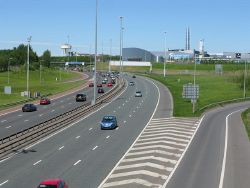
Westerhouse Road Interchange
Jump to navigation
Jump to search
| Westerhouse Road Interchange | |||
| Location Map ( geo) | |||
 | |||
| |||
| Location | |||
| Queenslie, Glasgow | |||
| County | |||
| Lanarkshire | |||
| Highway Authority | |||
| Transport Scotland | |||
| Junction Type | |||
| folded diamond | |||
| Roads Joined | |||
| M8 | |||
This article is about the current junction 10 on the M8.
For the original junction 10, see St James Interchange.
For the original junction 10, see St James Interchange.
Westerhouse Road Interchange is junction 10 of the M8.
Routes
| Route | To | Notes |
| Greenock, Glasgow Airport, City centre | ||
| Carlisle, Edinburgh | ||
| Shopping Park | Milne Way | |
| Easterhouse | Westerhouse Road | |
| Queenslie, Wellhouse | Bartiebeith Road | |
| Ballieston, Barlanark, Easthall | Wellhouse Road |
| Westerhouse Road Interchange | ||
| ||
|
