File:Road to Drum - Geograph - 1727343.jpg

From Roader's Digest: The SABRE Wiki
Jump to navigation Jump to search

Road_to_Drum_-_Geograph_-_1727343.jpg(640 × 359 pixels, file size: 72 KB, MIME type: image/jpeg)

Y topleft.gifY topright.gif
Description:Road to Drum An old road alignment, replaced when the M8 was built and now just serving residential properties. It used to run from Bathgate to Whitburn. The cameras are there to cajole the dumpers into going somewhere else.
Location:55.878906, -3.660426
Road:B7002
Date:25 02 2010
Photographer:(c) Copyright Richard Webb and licensed for reuse under this Creative Commons Licence
Source:Geograph

Map

Y btmleft.gifY btmright.gif

Galleries  | B7002 | unclassified

File history

Click on a date/time to view the file as it appeared at that time.

Date/TimeThumbnailDimensionsUserComment
current20:07, 23 October 2016Thumbnail for version as of 20:07, 23 October 2016640 × 359 (72 KB)Vlad (talk | contribs)
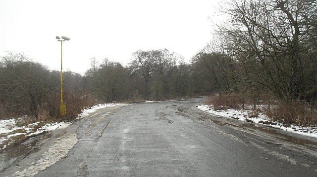
'''Road to Drum''' An old road alignment, replaced when the M8 was built and now just serving residential properties. It used to run from Bathgate to Whitburn. The cameras are there to cajole the dumpers into going somewhere else.

The following page uses this file:

Metadata

SABRE - The Society for All British and Irish Road Enthusiasts
Discuss - Digest - Discover - Help