File:Rotterdam ferry terminus, Hull - Geograph - 320322.jpg

From Roader's Digest: The SABRE Wiki
Jump to navigation Jump to search

Rotterdam_ferry_terminus,_Hull_-_Geograph_-_320322.jpg(640 × 427 pixels, file size: 65 KB, MIME type: image/jpeg)

Y topleft.gifY topright.gif
Description:
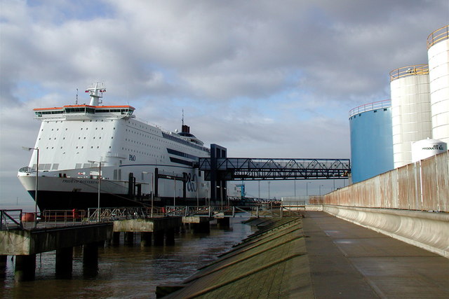
Rotterdam ferry terminus, Hull
Seen from the east, the gangway from the P&O Ferries 'Pride of Rotterdam' seems to lead directly into one of the storage containers to the west of King George Dock, at least some of which are owned by Tate & Lyle. It brings to mind the classic 1970s sci-fi film 'Soylent Green' in which people are processed as food, but that can't be true, can it? After all, human trafficking has been outlawed for two hundred years.
Location:53.741244, -0.279834
Road:A1033, E20
Date:24 01 2007
Photographer:� Copyright Paul Glazzard and licensed for reuse under this Creative Commons Licence
Source:Geograph

Map

Y btmleft.gifY btmright.gif

Galleries  | A1033 | E20 | Kingston upon Hull | Hull - Rotterdam ferry

File history

Click on a date/time to view the file as it appeared at that time.

Date/TimeThumbnailDimensionsUserComment
current10:24, 17 August 2010Thumbnail for version as of 10:24, 17 August 2010640 × 427 (65 KB)Abeaton (talk | contribs)'''Rotterdam ferry terminus, Hull'''<br/>Seen from the east, the gangway from the P&O Ferries 'Pride of Rotterdam' seems to lead directly into one of the storage containers to the west of King George Dock, at least some of which are owned by Tate & Lyle.

The following 4 pages use this file:

Metadata

SABRE - The Society for All British and Irish Road Enthusiasts
Discuss - Digest - Discover - Help