Gallery:A11 (Northern Ireland)
From Roader's Digest: The SABRE Wiki
Jump to navigation
Jump to search
A1-A99 (Northern Ireland) > A11 (Northern Ireland)
This gallery has no child categories
A11 (Northern Ireland)
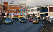
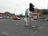
The Dunbar Link, Belfast (2)
See <a href='http://www.geograph.org.uk/photo/1715983'>J3474 : The Dunbar Link, Belfast (1)</a>. The view to Victoria Street from near Exchange Street. The southbound carriageway turns left towards Donegall Quay. Continue to <a href='http://www.geograph.org.uk/photo/1716048'>J3474 : The Dunbar Link, Belfast (3)</a>.
See <a href='http://www.geograph.org.uk/photo/1715983'>J3474 : The Dunbar Link, Belfast (1)</a>. The view to Victoria Street from near Exchange Street. The southbound carriageway turns left towards Donegall Quay. Continue to <a href='http://www.geograph.org.uk/photo/1716048'>J3474 : The Dunbar Link, Belfast (3)</a>.
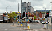
The Dunbar Link, Belfast (1)
The view towards the Nelson Street traffic lights and York Street from near Exchange Street. Continue to <a href='http://www.geograph.org.uk/photo/1716025'>J3474 : The Dunbar Link, Belfast (2)</a>.
The view towards the Nelson Street traffic lights and York Street from near Exchange Street. Continue to <a href='http://www.geograph.org.uk/photo/1716025'>J3474 : The Dunbar Link, Belfast (2)</a>.
The Dunbar Link, Belfast (4)
See <a href='http://www.geograph.org.uk/photo/1716048'>J3474 : The Dunbar Link, Belfast (3)</a>. The view from Nelson Street showing how the �Boat� <a href='http://www.geograph.org.uk/photo/1812309'>J3474 : The 'Boat' site, Belfast (42)</a> rises above what was previously a low-rise streetscape.
See <a href='http://www.geograph.org.uk/photo/1716048'>J3474 : The Dunbar Link, Belfast (3)</a>. The view from Nelson Street showing how the �Boat� <a href='http://www.geograph.org.uk/photo/1812309'>J3474 : The 'Boat' site, Belfast (42)</a> rises above what was previously a low-rise streetscape.
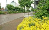
Frederick Street, Belfast Frederick Street runs from York Street (background) to Carrick Hill and forms part of an inner ring road. This one shows (I hope) how landscaping can, over time, improve even the drabbest of streets (especially on a dull and wet day).
