
I’ve been trying to find out if there’s a convention in place for this. For example, most of us are aware there would be space on the GB grid system to include the Channel Islands, and Ireland - Jersey would fit in grid square XD, for instance, just below SY.
However, I’m sure there’s also an Irish-style single-letter grid in place (again, with 6-figure references).
Grid references in the Channel Islands??
Moderator: Site Management Team

Re: Grid references in the Channel Islands??
The grid has a "false origin" at the bottom left of square SV. Any points further south or west than this are a bit problematic for the grid as they have a negative northing and/or a negative easting. The grid was never intended for such places.
You can see this by looking at the numbers in the margin of an OS map. The 2-digit numbers of the grid lines are really 3-digit numbers with the first digit suppressed. This extra digit is shown in some places in smaller type. If you go south or west of the false origin, the extra digit becomes negative.
100km squares were originally denoted by numbers - the letters came later. For example SV=00, SW=10, SX=20, SS=21, TL=52.
The letters are easier to extend than the numbers but some software probably depends on assuming the numbers are positive.
Squares whose letter name begins H (Shetland and northern Orkney) are more than 1000km north of the false origin, so they need an additional 1 at the beginning.
Re: Grid references in the Channel Islands??
That is very interesting. It also explains why some online sites may refuse to recognise those locations.
If the false origin was moved, would references need to be changed??
If the false origin was moved, would references need to be changed??

Re: Grid references in the Channel Islands??
The two-digit references to the false origin would need to change if there was a change in the false origin itself. If the false origin was to move to the south west corner of square XF to take the Channel Islands into account, the latter digit in the references would increase by 2 on each row of 100x100 km squares.
E-roads, M-roads, A-roads, N-roads, B-roads, R-roads, C-roads, L-roads, U-roads, footpaths
-
Micro The Maniac
- Member
- Posts: 1186
- Joined: Thu Jun 25, 2015 13:14
- Location: Blackwater Valley A331/A325/B3272
Re: Grid references in the Channel Islands??
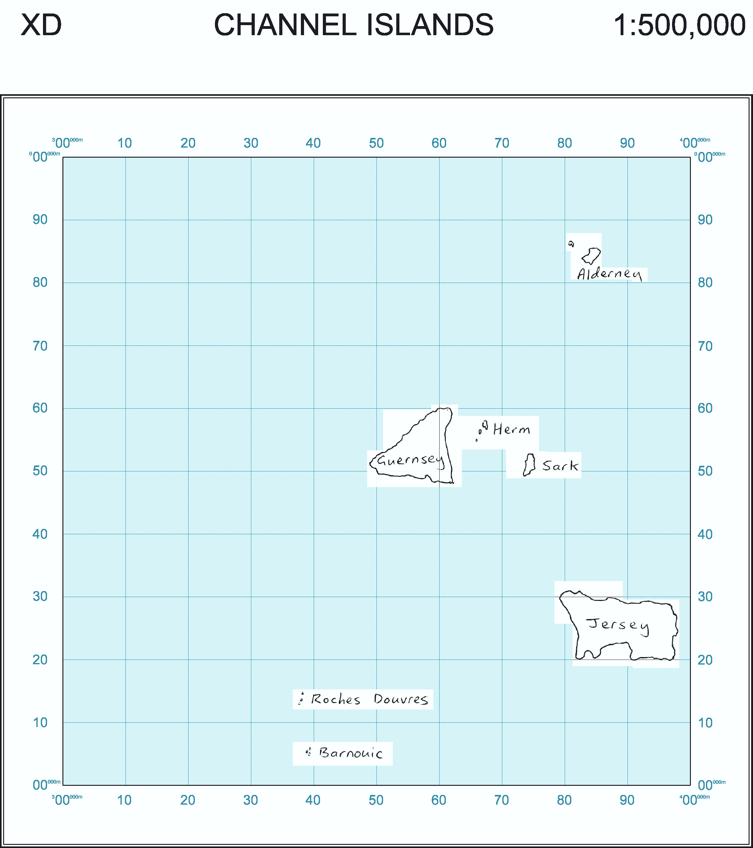
Alderney is WA, whilst Jersey and Guernsey are WV
It's a separate grid
http://www.bwars.com/content/channel-is ... -reference
It's a separate grid
http://www.bwars.com/content/channel-is ... -reference

Re: Grid references in the Channel Islands??
Yes, the Channel Islands would fit in the Great Britain National Grid in square XD, but (not being part of Great Britain) they are in Universal Transverse Mercator grid WV and WA. See also.
Re: Grid references in the Channel Islands??
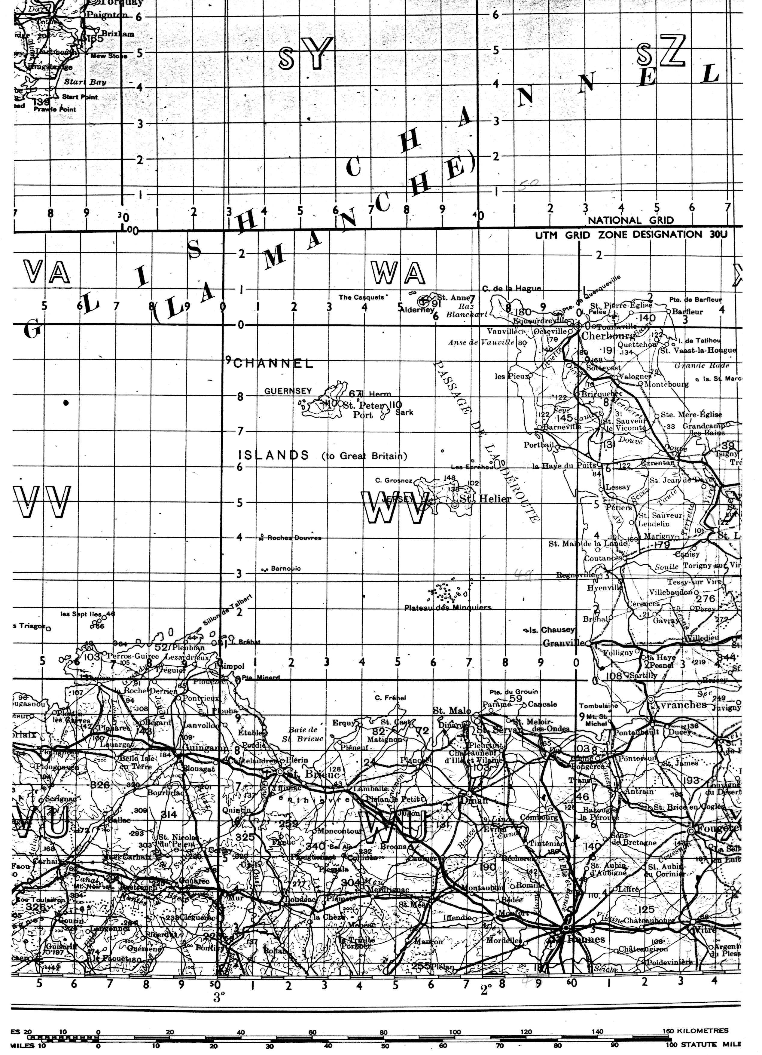
I did have a browsable 1:50,000 map of the Channel Islands on the UTM grid which I put together for Geograph's Channel Islands before they got their own mapping system working. When I moved servers a couple of years ago I didn't copy it across as it was rather a bandwidth hog.
Edit: Here we are, I've put it back online. It may prompt me to finish off cleaning up the mapping.
Edit: Here we are, I've put it back online. It may prompt me to finish off cleaning up the mapping.
-
Vierwielen

- Member
- Posts: 5715
- Joined: Sun Jun 08, 2008 21:21
- Location: Hampshire
Re: Grid references in the Channel Islands??
For the record, the zero point of the National Grid is 2 degrees West and 49 degrees North. The meridian through this point passes through Poole Harbour.
As mentioned elsewhere, the "false origin" is 500 km to the west of this point, but due to the earth's curvature, a little to the north of the 49th parallel. (See Wikipedia for more details.)
As mentioned elsewhere, the "false origin" is 500 km to the west of this point, but due to the earth's curvature, a little to the north of the 49th parallel. (See Wikipedia for more details.)
Re: Grid references in the Channel Islands??
So the grid system is clearly able to take the Channel Islands into account - and Ireland too, for that matter.
-
FosseWay

- Assistant Site Manager
- Posts: 19725
- Joined: Thu Feb 23, 2006 22:26
- Location: Gothenburg, Sweden
Re: Grid references in the Channel Islands??
Not without using negative numbers, as stated above.
Also, the further west or east from the true origin of the grid you go, the more discrepancy there is between grid north and true north. This is why the true origin is in longitudinal terms on a meridian that runs up an approximation to the N-S axis of Great Britain, and not in the same place as the false origin, which is located so as to include all of Great Britain and its politically dependent islands without needing negative numbers.
In the case of the Channel Islands, you could include them in the GB grid without introducing more distortion anywhere else than already exists and without resorting to negative numbers, by moving the false origin a suitable distance south. But unless you moved it a whole 500 km south, it would have an effect on the numbering of the existing large squares and thus on all individual grid references that are quoted to a national level of accuracy.
In the case of Ireland, the same applies wrt negative numbers, but also the entire island would be skewed towards the extreme end of the available range of distortions between grid and true north, since the true origin's meridian lies considerably east of anywhere in Ireland. You could move the true origin further west to centre it over the entire archipelago, but this would result in greater discrepancy at west and east than is currently the case for either of the individual National Grids.
Ultimately the NG system was not conceived to provide a comparative location tool between places that are separated by lots of sea. If the OS had been operating in the US or Canada, it would have had to think differently, since a British-style solution would either have involved huge discrepancies on the coasts (ironically where most of the users are) or several different true origins with resultant ambiguities and non-square "squares" at the point where each individual mini-grid meets its neighbour. But for GB by itself and for Ireland by itself, the system works well enough. There's no particular need to be able to quote the location of somewhere in Ireland or the Channel Islands by reference to a grid based in GB; you're better off simply having a separate grid in these places.
Did you know there's more to SABRE than just the Forums?
Add your roads knowledge to the SABRE Wiki today!
Have you browsed SABRE Maps recently? Try getting involved!
Add your roads knowledge to the SABRE Wiki today!
Have you browsed SABRE Maps recently? Try getting involved!
-
Vierwielen
- Member
- Posts: 5715
- Joined: Sun Jun 08, 2008 21:21
- Location: Hampshire
Re: Grid references in the Channel Islands??
The grid system could take in the Channel Islands quite easily - the origin is about 20km south of Jersey. However there would be a problem taking in Ireland - UTM splits the world up into 6 degree bands - the bands that affect the GB being between 0 degrees and 6 degrees West and between 0 degrees and 6 degrees East. To get an equivalent quality, the OS grid shoudl only span between 1 degree east and 5 degrees west. This means that anything east of Canturbury or Colchester is distorted to a greater degree than one would find on a UTM map and similarly anything west of Truro or Fort WIlliam. The advantage of using the OS grid in preference to UTM is that there is no need to "stitch" two segments along the Greenwich meridian.
Re: Grid references in the Channel Islands??
The central meridian for GB OS mapping is 2 deg W of Greenwich, which is the only line of latitude or longitude to coincide with a grid line - the line N-S [4]00, the boundary between squares SY and SZ, or between SD and SE, etc.FosseWay wrote: ↑Tue Aug 20, 2019 13:35Not without using negative numbers, as stated above.
Also, the further west or east from the true origin of the grid you go, the more discrepancy there is between grid north and true north. This is why the true origin is in longitudinal terms on a meridian that runs up an approximation to the N-S axis of Great Britain, and not in the same place as the false origin, which is located so as to include all of Great Britain and its politically dependent islands without needing negative numbers.
...
In the case of Ireland, the same applies wrt negative numbers, but also the entire island would be skewed towards the extreme end of the available range of distortions between grid and true north, since the true origin's meridian lies considerably east of anywhere in Ireland. You could move the true origin further west to centre it over the entire archipelago, but this would result in greater discrepancy at west and east than is currently the case for either of the individual National Grids.
Ireland, north and south, has its own grid, which I believe uses the same map projection (transverse Mercator), but centred on 8 deg west.
I recently noticed an interesting curiosity about the A-Z GB road atlas. I'm looking at the 2019 edition but it's probably the same every year. It's mostly based on the GB grid but pages 92-93 show Northern Ireland and are based on the Irish grid. The "key to map pages" dishonestly shows these pages as having edges parallel to those of all the other pages, but if you compare the overlap area on pages 50 and 93, you'll see they have two different ideas of north.
-
Steven

- SABRE Maps Coordinator
- Posts: 19257
- Joined: Tue Feb 12, 2002 20:39
- Location: Wolverhampton, Staffordshire
- Contact:
Re: Grid references in the Channel Islands??
Not quite.
There is the Irish Grid and the Irish Transverse Mercator Grid; which are not the same things as one another. For example, an easting of 310000 on the Irish Grid is 710000 on the Irish TM Grid.
Alternatively, you could look on SABRE Maps, at the recently added Sheet 18 of the 1:250,000 Fifth Edition (Military) which shows the Irish Grid and the OSGB National Grid crashing into one another.wrinkly wrote: ↑Mon Jan 11, 2021 14:31 I recently noticed an interesting curiosity about the A-Z GB road atlas. I'm looking at the 2019 edition but it's probably the same every year. It's mostly based on the GB grid but pages 92-93 show Northern Ireland and are based on the Irish grid. The "key to map pages" dishonestly shows these pages as having edges parallel to those of all the other pages, but if you compare the overlap area on pages 50 and 93, you'll see they have two different ideas of north.
Steven
Motorway Historian
Founder Member, SABRE ex-Presidents' Corner
Add your roads knowledge to the SABRE Wiki today!
Have you browsed SABRE Maps recently? Try getting involved!
Motorway Historian
Founder Member, SABRE ex-Presidents' Corner
Add your roads knowledge to the SABRE Wiki today!
Have you browsed SABRE Maps recently? Try getting involved!
-
Micro The Maniac
- Member
- Posts: 1186
- Joined: Thu Jun 25, 2015 13:14
- Location: Blackwater Valley A331/A325/B3272
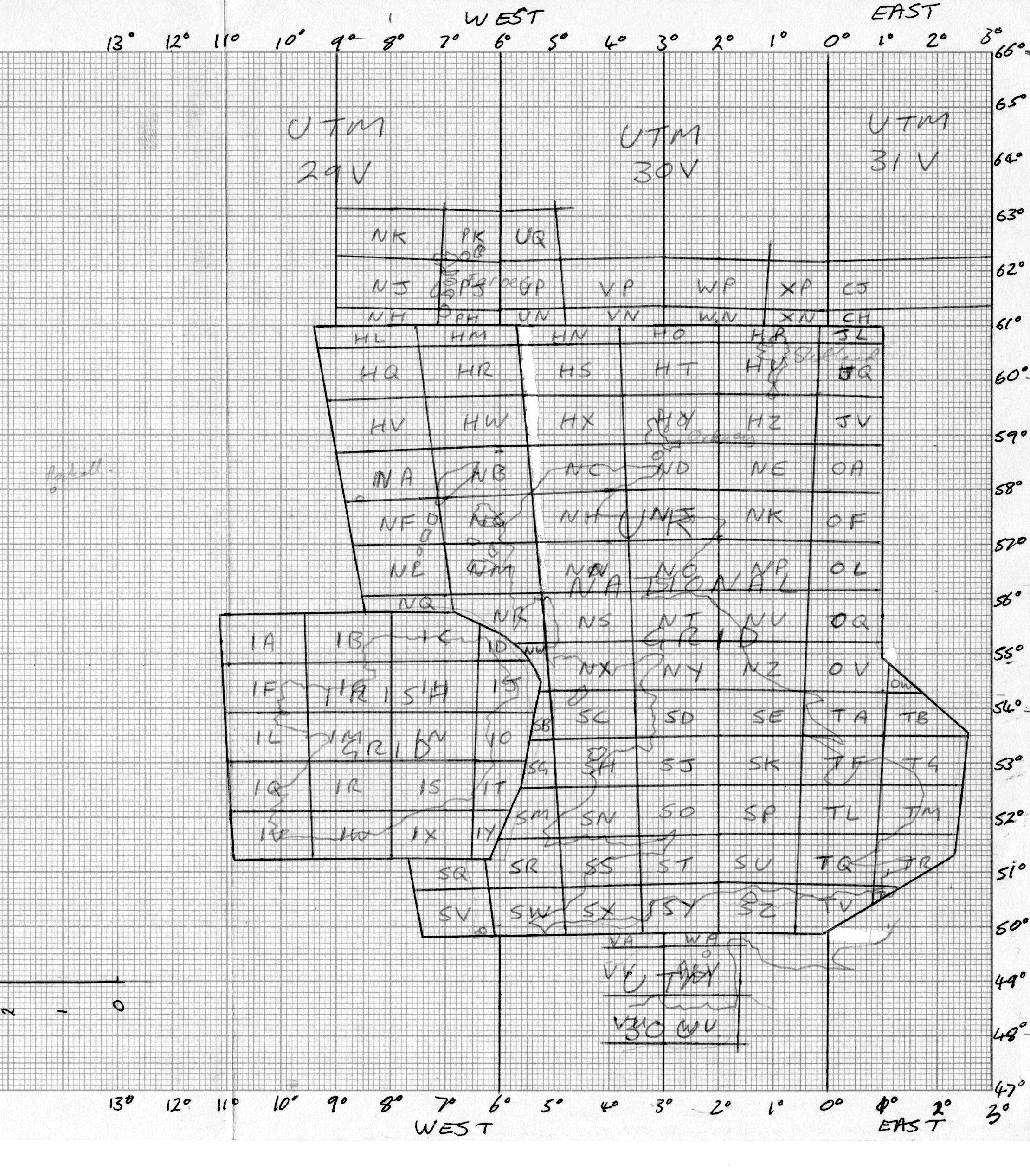
Re: Grid references in the Channel Islands??
- uk_map.gif (7.93 KiB) Viewed 6889 times