
Can anyone suggest a sensible reason why the A90 and A92 respectively failed to properly cross the Forth and Tay ferries from 1922 right through until the bridges were built?
As can be seen on the 1922 MOT map, the A90 more or less meets the ferry slipway at South Queensferry, but at North Queensferry it continues straight past and down to the old harbour area. This is much clearer on the 1950s OS 1:25,000 sheet, by which time the A904 has been extended to South Queensferry hiding the A90's extent, although the OS Six Inch map marks the A904 at the slipway, suggesting that it ends there.
The Tay ferry is in some ways even more perplexing. Although the MOT map is not explicit, the Six Inch Sheet from c1947 clearly shows that the A92 meets the A914 and B946 at the bottom of James Street getting on for half a mile north of the ferry pier, making traffic use the A914 to cross the ferry and find the rest of the A92. At least in Dundee, the A92 appears to cross the top of the ferry slipway, even if it does continues past to 'terminate' end-on with the B911.
I appreciate that in 1922 neither ferry was really set up for carrying vehicles (they could maybe crane cars on with a derrick?), but by the same token, why route the A90 and A92 across the ferries (however loosely) if vehicles couldn't actually go that way? An element of future proofing no doubt, and the Forth crossing was probably viewed as the main route to Perth and the north, but if that is the case why didn't the A9 cross here? And why did the routes never get adjusted to meet the ferries?
Forth & Tay Ferries
Moderator: Site Management Team
Forth & Tay Ferries
Rob.
My mission is to travel every road and visit every town, village and hamlet in the British Isles.
I don't like thinking about how badly I am doing.
My mission is to travel every road and visit every town, village and hamlet in the British Isles.
I don't like thinking about how badly I am doing.

Re: Forth & Tay Ferries
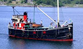
I have no personal knowledge of the how's and why's but I did come across these photos of the Tay ferries which does show vehicles being carried in 1929.rileyrob wrote: ↑Sun Apr 14, 2024 08:41 Can anyone suggest a sensible reason why the A90 and A92 respectively failed to properly cross the Forth and Tay ferries from 1922 right through until the bridges were built?
As can be seen on the 1922 MOT map, the A90 more or less meets the ferry slipway at South Queensferry, but at North Queensferry it continues straight past and down to the old harbour area. This is much clearer on the 1950s OS 1:25,000 sheet, by which time the A904 has been extended to South Queensferry hiding the A90's extent, although the OS Six Inch map marks the A904 at the slipway, suggesting that it ends there.
The Tay ferry is in some ways even more perplexing. Although the MOT map is not explicit, the Six Inch Sheet from c1947 clearly shows that the A92 meets the A914 and B946 at the bottom of James Street getting on for half a mile north of the ferry pier, making traffic use the A914 to cross the ferry and find the rest of the A92. At least in Dundee, the A92 appears to cross the top of the ferry slipway, even if it does continues past to 'terminate' end-on with the B911.
I appreciate that in 1922 neither ferry was really set up for carrying vehicles (they could maybe crane cars on with a derrick?), but by the same token, why route the A90 and A92 across the ferries (however loosely) if vehicles couldn't actually go that way? An element of future proofing no doubt, and the Forth crossing was probably viewed as the main route to Perth and the north, but if that is the case why didn't the A9 cross here? And why did the routes never get adjusted to meet the ferries?
https://www.newportontayhistory.org.uk/ ... erry-boats
-
Ritchie333

- SABRE Developer
- Posts: 11920
- Joined: Tue May 20, 2003 20:40
- Location: Ashford, Kent
- Contact:
Re: Forth & Tay Ferries
I can't find the original documentation (it's in National Archives file MT 39/241) but the original route for the A9 was the direct road from Edinburgh to Perth via the Forth Ferry, but cancelled fairly late in proceedings and replaced by the "long way round" via Stirling.
The most likely explanation for the A90 continuing past the ferry terminal is that in those days, goods traffic was the predominant purpose for high quality roads, and there was probably sufficient traffic along the two piers in North Queensferry to justify a Class I budget. Otherwise, using the strict rules and purposes of the original numbering system, a good quality road would have run out at the first pier, and a lesser quality road continued up to the second. That doesn't really make sense.
A simpler explanation, and one that also can be put towards the Tay Ferry is simply - the MOT made a mistake and didn't care. Again, it comes back to the road numbering system being primarily devised as a way of sorting out budget allocations and expenditures, and that it could be used by travellers was a convenient afterthought.
--
SABRE Maps - all the best maps in one place....
SABRE Maps - all the best maps in one place....
Re: Forth & Tay Ferries
It looks as if the ferry didn't carry many vehicles. Would we be talking 100 vehicles an hour?
That would suggest that the road numbers were labels for administration rather than indicators for motorists to find a sensible route (which my understanding of the case 100 years ago).
That would suggest that the road numbers were labels for administration rather than indicators for motorists to find a sensible route (which my understanding of the case 100 years ago).
Re: Forth & Tay Ferries
Looking up the figures I find that in 1923 there were 383,525 cars on the road in the UK so I doubt there were many cars on the road in Scotland north of the Forth and Clyde at the time apart from those carrying freight and making deliveries. Between there and Perth however was served quite well by rail, the key form of freight transport farther north was the puffers. Every coastal settlement had a quay and the modern ferries are still very much in business.
Re: Forth & Tay Ferries
Although it didn't have the facilities to carry many, the two ferries were almost wholly for vehicles (including horse-drawn). Any passengers would have taken the much more practical and convenient adjacent railway.
Re: Forth & Tay Ferries
Thanks for the thoughts so far. The 'numbers not for motorists' argument makes sense for 1922, but doesn't really explain why they didn't get revised in later years. Unlike England and Wales who did a big renumber in 1935 and then tried to leave well alone, the Scottish Office seem to have kept fiddling through until at least 1945/6 when there was a substantial set of changes. As vehicle traffic increased, you would have thought that they would have adjusted the A90 and A92 to reach the ferry slipways on both sides of the firths. As it was, neither route could really be considered to be continuous.
I think you are confusing East and West coast here. The Forth and Tay estuaries we are discussing are on Scotland's East Coast, while the Clyde Puffers predominantly operated on the West Coast and out to the Hebrides. While it seems a few did venture across the Forth & Clyde Canal into the Firth of Forth, they were not normally (if ever) to be found serving the East Coast communities further north. There are also no ferries 'in business' on the Forth or Tay estuaries, except the pleasure boats out to the various islands in (and just outside) the Firth of Forth.
Rob.
My mission is to travel every road and visit every town, village and hamlet in the British Isles.
I don't like thinking about how badly I am doing.
My mission is to travel every road and visit every town, village and hamlet in the British Isles.
I don't like thinking about how badly I am doing.
Re: Forth & Tay Ferries
They were taking vehicles on the Queensferry service. Fife Free Press of 25 June 1921 reported on a House of Commons question to the Minister of Transport which included...."that on account of the prohibitive increase of charges for the conveyance of bicycles, motor cycles, and motor cars the use of the main means of road communication between Edinburgh and Fifeshire has been practically closed".rileyrob wrote: ↑Sun Apr 14, 2024 08:41 I appreciate that in 1922 neither ferry was really set up for carrying vehicles (they could maybe crane cars on with a derrick?), but by the same token, why route the A90 and A92 across the ferries (however loosely) if vehicles couldn't actually go that way? An element of future proofing no doubt, and the Forth crossing was probably viewed as the main route to Perth and the north, but if that is the case why didn't the A9 cross here? And why did the routes never get adjusted to meet the ferries?
The Hansard entry is at https://api.parliament.uk/historic-hans ... ueensferry
Tolls were also reported for the Tay Ferry, Burntisland and Granton Ferry and Queensferry in 1923 and 1925 which included charges for motor cars, motor vans, char-a-bancs. They were still complaining about the charges on the Queensferry!
Ian

Re: Forth & Tay Ferries
The 6" map doesn't necessarily agree with your point! That shows the ferry leaving from the Town Pier in North Queensferry (the one the A90 points at) and then states explicitly that the A90 crosses the ferry to the south bank. Do we know for certain which pier was used in North Queensferry? Given the western pier is labelled as Railway Pier does that mean it was used for goods and the eastern pier for vehicular traffic?rileyrob wrote: ↑Sun Apr 14, 2024 08:41 ...although the OS Six Inch map marks the A904 at the slipway, suggesting that it ends there.
I think this has already been stated but I'd hazard that there was sufficient traffic along Main Street in North Queensferry to warrant a Class I road - and why not A90 as it was in the area anyway? I'd say that most traffic would have been going to the town rather than through it.
"If you expect nothing from somebody you are never disappointed." - Sylvia Plath

Re: Forth & Tay Ferries
I understand that what is now the Orkney and Shetland ferry to Aberdeen used to carry on to Leith too, but for most traffic that would have been quite a niche route I suspect.
Owen Rudge
http://www.owenrudge.net/
http://www.owenrudge.net/
-
Summers-lad
- Member
- Posts: 117
- Joined: Thu May 11, 2023 22:40
Re: Forth & Tay Ferries
There was a goods yard beside the railway pier until 1954 according to https://www.railscot.co.uk/locations/N/ ... ferry_1st/, which tallies with the 1:25000 map of 1956 still showing a railway there. Therefore it seems more likely that the Town Pier would have been used for the ferry, despite what the MoT map shows. Against this though is the fact that the 6-inch map shows the Town Pier stopping short of the low water mark, which if correct, would have limited the operating hours of the ferry.vlad wrote: ↑Sun Apr 14, 2024 20:52The 6" map doesn't necessarily agree with your point! That shows the ferry leaving from the Town Pier in North Queensferry (the one the A90 points at) and then states explicitly that the A90 crosses the ferry to the south bank. Do we know for certain which pier was used in North Queensferry? Given the western pier is labelled as Railway Pier does that mean it was used for goods and the eastern pier for vehicular traffic?rileyrob wrote: ↑Sun Apr 14, 2024 08:41 ...although the OS Six Inch map marks the A904 at the slipway, suggesting that it ends there.