File:Crossing Amman Valley railway near site... (C) Ben Brooksbank - Geograph - 3556945.jpg
Jump to navigation
Jump to search

No higher resolution available.
Crossing_Amman_Valley_railway_near_site..._(C)_Ben_Brooksbank_-_Geograph_-_3556945.jpg (640 × 424 pixels, file size: 134 KB, MIME type: image/jpeg)
| |||||||||||||||||||||||||
|
Galleries | Level Crossing | Carmarthenshire | ||
File history
Click on a date/time to view the file as it appeared at that time.
| Date/Time | Thumbnail | Dimensions | User | Comment | |
|---|---|---|---|---|---|
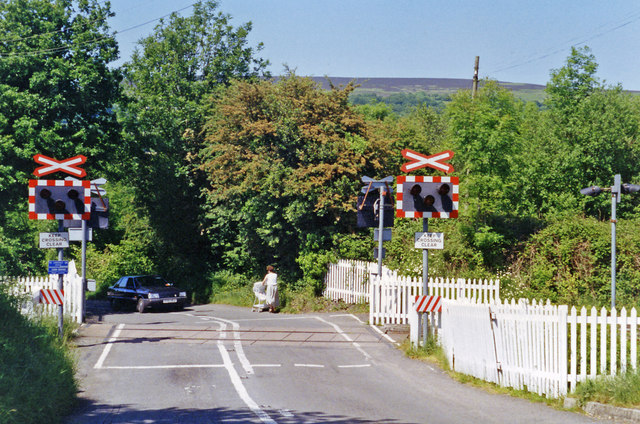
| current | 10:50, 4 November 2013 | | 640 × 424 (134 KB) | Glen (talk | contribs) | '''Crossing Amman Valley railway near site... (C) Ben Brooksbank '''<br/>View northward, across ex-GWR Pantyfynnon (to left) - (to right) Brynamman (West) branch, which closed to passengers 18/8/58, Garnant station having been about 200 yards to the le... |
File usage
The following 4 pages use this file:
_Ben_Brooksbank_-_Geograph_-_3556945.jpg&oldid=376652)