File:Newton Cap viaduct - Geograph - 14307.jpg
Jump to navigation
Jump to search

No higher resolution available.
Newton_Cap_viaduct_-_Geograph_-_14307.jpg (600 × 314 pixels, file size: 25 KB, MIME type: image/jpeg)
| |||||||||||||||||||||||||
|
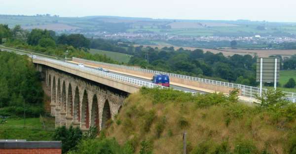
Galleries | A689 | Bishop Auckland | Newton Cap Viaduct | ||
File history
Click on a date/time to view the file as it appeared at that time.
| Date/Time | Thumbnail | Dimensions | User | Comment | |
|---|---|---|---|---|---|
| current | 13:09, 9 July 2010 | | 600 × 314 (25 KB) | Bob@romiley1 (talk | contribs) | '''Newton Cap viaduct'''<br/>Originally a rail bridge, re-decked for road traffic, now carrying A689 across the River Wear |
File usage
The following 4 pages use this file: