File:Oxford Road, Uxbridge - Geograph - 381411.jpg

From Roader's Digest: The SABRE Wiki
Jump to navigation Jump to search

Oxford_Road,_Uxbridge_-_Geograph_-_381411.jpg(640 × 481 pixels, file size: 90 KB, MIME type: image/jpeg)

Y topleft.gifY topright.gif
Description:
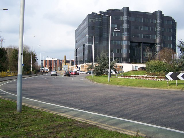
Oxford Road, Uxbridge
Looking north up Oxford road. The dark grey building is named The Atrium. Looking down the road to the building in the distance, this is the former site of Uxbridge High Street railway station.
Location:51.548678, -0.482912
Road:A4020
Date:29 03 2007
Photographer:� Copyright Rob Emms and licensed for reuse under this Creative Commons Licence
Source:Geograph

Map

Y btmleft.gifY btmright.gif

Galleries  | A4020 | Uxbridge

File history

Click on a date/time to view the file as it appeared at that time.

Date/TimeThumbnailDimensionsUserComment
current21:29, 9 April 2010Thumbnail for version as of 21:29, 9 April 2010640 × 481 (90 KB)Sabristo simon (talk | contribs)'''Oxford Road, Uxbridge'''<br/>Looking north up Oxford road. The dark grey building is named The Atrium. Looking down the road to the building in the distance, this is the former site of Uxbridge High Street railway station.

The following page uses this file:

Metadata

SABRE - The Society for All British and Irish Road Enthusiasts
Discuss - Digest - Discover - Help