File:Ure Bypass Bridge - Geograph - 1654673.jpg

From Roader's Digest: The SABRE Wiki
Jump to navigation Jump to search

Ure_Bypass_Bridge_-_Geograph_-_1654673.jpg(640 × 427 pixels, file size: 69 KB, MIME type: image/jpeg)

Y topleft.gifY topright.gif
Description:
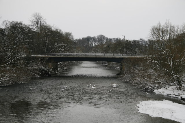
Ure Bypass Bridge
View downstream from North Bridge. Visible in the middle of the river, covered with snow, are all that remains of some of the pillars from the dismantled railway viaduct.
Location:54.142941, -1.513791
Road:A61
Date:09 01 2010
Photographer:� Copyright David Rogers and licensed for reuse under this Creative Commons Licence
Source:Geograph

Map

Y btmleft.gifY btmright.gif

Galleries  | A61 | Ripon By Pass Bridge | Ripon

File history

Click on a date/time to view the file as it appeared at that time.

Date/TimeThumbnailDimensionsUserComment
current11:24, 5 April 2010Thumbnail for version as of 11:24, 5 April 2010640 × 427 (69 KB)Bob@romiley1 (talk | contribs)'''Ure Bypass Bridge'''<br/>View downstream from North Bridge. Visible in the middle of the river, covered with snow, are all that remains of some of the pillars from the dismantled railway viaduct.

The following 3 pages use this file:

Metadata

SABRE - The Society for All British and Irish Road Enthusiasts
Discuss - Digest - Discover - Help