Gallery:Black Country Route

From Roader's Digest: The SABRE Wiki
Jump to navigation Jump to search
Road Projects > Black Country Route


This gallery has no child categories
Black Country Route
 
 
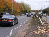
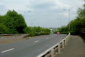
Black Country Route View - Geograph - 1680355.jpg
Black Country Route View
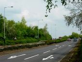
Black Country Route, Bilston, Wolverhampton - Geograph - 1796060.jpg
A463 Black Country Route, Bilston, Wolverhampton
Just beyond this roundabout, the route bypasses the centre of Bilston as it makes its way eastward to the M6 and Walsall.

Black Country Route - Geograph - 2143769.jpg
Black Country Route
The view from Oxford Street Island in Bilston, Wolverhampton along the Route towards the M6.
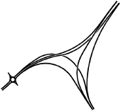
The Lunt.png
Original design for The Lunt Junction from the late 1980's
A454 Cantilever sign - Coppermine - 1946.jpg
A454 Cantilever sign

We should have these at motorway gore perhaps, instead of the piddily gore signs. This is the only signage for this junction however (it's on the A454 near the M6)

Posted by 404simon on 4/25/2004
Black Country Route.jpg
Black Country Route
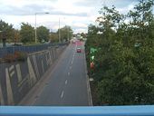
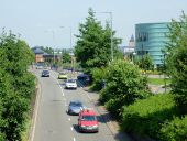
Black Country Route in Bilston,... (C) Roger Kidd - Geograph - 3549399.jpg
Black Country Route in Bilston,... (C) Roger Kidd
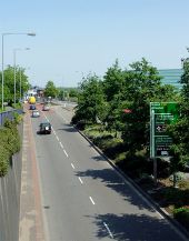
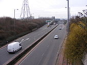
The dual carriageway A463 Looking east from the footbridge at the west bound traffic. The unsightly blue-green building on the right is the new Bert Williams Leisure Centre.
Black Country Route in Bilston,... (C) Roger Kidd - Geograph - 3549383.jpg
Black Country Route in Bilston,... (C) Roger Kidd
The A463 Looking east from the footbridge.
Vulcan Road Bridge - Geograph - 2140877.jpg
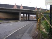
Vulcan Road Bridge The A463 Black Country Route passes over the U121 Lunt Road, Bilston.
Tower of Light - Geograph - 2143640.jpg
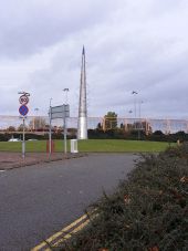
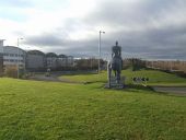
Tower of Light The view of the sculpture by Eillis O'Connel on Vulcan Road Island, Bilston. The yellow fence marks the border of Bilston Football Ground and the Black Country Route.
Redevelopment on the Black Country Route - Geograph - 1086483.jpg
Redevelopment on the Black Country Route This development has appeared over the last few months on a brown field site near Bilston.
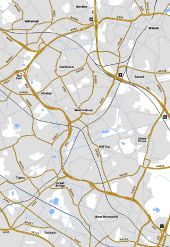
Black Country Spine Road Original.jpg
Original design for the Black Country Spine Road based on plans from 1988. The whole route was proposed as a high quality dual carriageway allowing uninterrupted travel between M5 J1 and M6 J10. Unfortunately poor ground conditions dramatically increased the cost of the scheme from £50m to £245m which was the death knell for the GSJ's. Severe compromises were made to reduce the cost including online dualling of the existing road between Wednesbury and Moxley and replacing all the GSJ's with roundabouts.

The Lunt is an interesting design. I had assumed the existing junction would have been GSJ'd by utilising the flaring for a flyover. I had never envisaged anything more elaborate was planned, especially something fully freeflowing. The freeflowing nature is somewhat spoilt by the roundabout immediately to the west but everything west of there is at-grade anyway and was planned that way as soon as the earlier motorway scheme was cancelled.

Another interesting junction is the northern of the two roundabouts at Wednesbury. There is an underpass beneath the roundabout for traffic from the A461 to the local road serving the local businesses. This makes it a three level junction.

Although not part of the Spine Road, the junctions on the A454 immediately west of M6 J10 are shown differently on late 1980's plans to what was eventually built. Two westbound offslips in quick succession are shown with no eastbound equivalents - the B4464 catering for eastbound movements. The offslip nearest the M6 was built but the second one was replaced with a full access roundabout GSJ which is arguably much better as it takes traffic off the B4464 and other local roads.

Finally, I have altered the road numbering from what currently exists. A41 now continues northwards to The Lunt. A41 west of Moxley becomes a continuation of the A4038. A41 between Wednesbury and Moxley now downgraded in its entirety. Until I know otherwise, this is purely speculation on my part but makes perfect sense had the original route been built.
A463 Black Country Route at Spring Vale, Wolverhampton - Geograph - 3964947.jpg
A463 Black Country Route at Spring Vale, Wolverhampton Looking north-east, from where the road crosses the canal and railway.
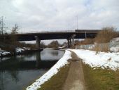
Black Country Route Bridge - Geograph - 3388730.jpg
Black Country Route Bridge The view down the Birmingham Canal to the A463 road bridge with the Wolverhampton to Birmingham railway alongside.
A463 Black Country Route at Spring Vale, Wolverhampton - Geograph - 3962337.jpg
A463 Black Country Route at Spring Vale, Wolverhampton Looking north-east, the two approaching cars have just crossed the Birmingham Canal Navigation (Wolverhampton Level).
The Black Country Route to Dudley - Geograph - 4010488.jpg
The Black Country Route to Dudley
Poundland Depot - Geograph - 3858346.jpg
Poundland Depot The view of the depot alongside the Black Country Route (A463) in Bilston, looking towards Spring Vale Island.
 

SABRE - The Society for All British and Irish Road Enthusiasts
Discuss - Digest - Discover - Help