Category:Snow Roads Scenic Route pictures
Jump to navigation
Jump to search
Media in category 'Snow Roads Scenic Route pictures'
The following 84 files are in this category, out of 84 total.
 A 83 and Car Park, Glenshee Ski Area - Geograph - 1721871.jpg 640 × 463; 48 KB
 A93 - Coppermine - 20272.jpg 1,024 × 768; 714 KB
 A93 - old and current.jpg 2,048 × 1,536; 832 KB
 A93 at Braemar - Geograph - 12821.jpg 640 × 480; 97 KB
 A93 Braemar - Coppermine - 5414.jpg 1,024 × 768; 300 KB
 A93 Braemar - Coppermine - 5415.jpg 1,024 × 768; 259 KB
 A93 Devils Elbow - Snow poles.jpg 1,280 × 960; 179 KB
 A93 Glenshee - Coppermine - 5416.jpg 1,024 × 768; 264 KB
 A93 near the Spittal of Glenshee - Coppermine - 5418.jpg 1,024 × 768; 276 KB
 A93 near the Spittal of Glenshee - Coppermine - 5419.jpg 1,024 × 768; 273 KB
 A93 RCS. - Coppermine - 5413.jpg 1,024 × 768; 290 KB
 A93 Spittal of Glenshee - Coppermine - 5417.jpg 1,024 × 768; 272 KB
 A93 Spittal of Glenshee - Coppermine - 5420.jpg 1,024 × 768; 283 KB
 A939 - Coppermine - 20274.jpg 1,024 × 768; 509 KB
 A939 - Coppermine - 20275.jpg 1,024 × 768; 461 KB
 A939 climbing towards the Lecht - Geograph - 1726013.jpg 640 × 468; 28 KB
 A939 Corgarff - A939 closed when lights flash sign.jpg 2,000 × 1,506; 995 KB
 A939 Corgarff - Advance direction sign from north.jpg 2,000 × 1,500; 978 KB
 A939 Corgarff - Advance direction sign from south.jpg 2,000 × 1,506; 975 KB
 A939 Corgarff - Closed at Cock Bridge hinged sign.jpg 2,000 × 1,500; 929 KB
 A939 Corgarff - Closed at Cock Bridge when lights flash sign.jpg 2,000 × 1,506; 994 KB
 A939 Corgarff - Closed at Lecht hinged sign.jpg 2,000 × 1,500; 928 KB
 A939 Corgarff - Colnabaichin Bridge from river.jpg 2,000 × 1,506; 989 KB
 A939 Corgarff - Direction signs.jpg 4,080 × 3,072; 975 KB
 A939 Corgarff - Hump bridge & risk of grounding.jpg 2,000 × 1,506; 991 KB
 A939 Corgarff - looking across Colnabaichin Bridge.jpg 2,000 × 1,506; 997 KB
 A939 Corgarff - Weight limit diversion sign.jpg 2,000 × 1,506; 984 KB
 A939 Foddletter - Highland Tourist Route sign.jpg 2,000 × 1,506; 973 KB
 A939 Gairnshiel - Direction signs.jpg 2,000 × 1,506; 970 KB
 A939 Gairnshiel Bridge - aerial of new bridge construction - August 2022.jpg 2,000 × 1,333; 948 KB
 A939 Gairnshiel Bridge - aerial of old bridge from west - August 2022.jpg 2,000 × 1,332; 982 KB
 A939 Gairnshiel Bridge - old bridge from north - August 2022.jpg 2,000 × 1,506; 997 KB
 A939 Gairnshiel Bridge - wide aerial of bridge from NW - August 2022.jpg 2,000 × 1,333; 998 KB
 A939 Snow gates - Coppermine - 16915.jpg 1,280 × 960; 229 KB
 A939 Snow gates - Coppermine - 16916.jpg 1,280 × 960; 285 KB
 A939 Snow gates - Coppermine - 16917.jpg 1,280 × 960; 249 KB
 A939 Speybridge - Advance direction sign.jpg 2,000 × 1,500; 969 KB
 A939 Speybridge - Highland Tourist Route.jpg 2,000 × 1,500; 998 KB
 A939 Speybridge - Services sign.jpg 2,000 × 1,500; 971 KB
 A939 Speybridge - Snow Roads sign.jpg 2,000 × 1,500; 974 KB
 A939 Tomintoul - Advance direction signs.jpg 2,000 × 1,506; 979 KB
 A939 Tomintoul - Direction signs.jpg 2,000 × 1,506; 985 KB
 A939 Tomintoul - Distilleries direction sign.jpg 2,000 × 1,506; 984 KB
 A939-b9136-signs.jpg 640 × 427; 130 KB
 A939-b9136.jpg 640 × 427; 121 KB
 A939-br-avon1.jpg 640 × 427; 136 KB
 A939-br-avon2.jpg 640 × 427; 127 KB
 A939-lechd1.jpg 640 × 427; 143 KB
 A939-lecht2.jpg 640 × 427; 277 KB
 A939-lecht3.jpg 640 × 427; 243 KB
 A939LechtAug16.jpg 2,592 × 1,728; 1.45 MB
 A944 Corgarff - AA telephone post and ADS.jpg 2,000 × 1,506; 986 KB
 A944 Corgarff - Police notice A939 closed hinged sign.jpg 2,000 × 1,506; 983 KB
 Blairgowrie - Coppermine - 19973.JPG 1,024 × 768; 120 KB
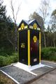 Box 472 - Geograph - 2065390.jpg 427 × 640; 94 KB
 Br-cally2.jpg 640 × 427; 331 KB
 Br-leachd.jpg 640 × 427; 308 KB
 Bridge over the River Don - Geograph - 584875.jpg 640 × 480; 267 KB
 Cock-br1.jpg 640 × 404; 255 KB
 Colnabaichin-br1.jpg 640 × 366; 287 KB
 Colnabaichin-br2.jpg 640 × 379; 280 KB
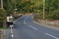
 Deserted and Peaceful near Dava - Geograph - 1160215.jpg 640 × 480; 67 KB
 Devils Elbow - A93 - Coppermine - 16911.jpg 1,280 × 960; 172 KB
 Devils Elbow - A93 - Coppermine - 16912.jpg 1,280 × 960; 203 KB
 Devils Elbow - A93 - Coppermine - 16913.jpg 1,280 × 960; 155 KB
 Direction sign on A939 (2).jpg 485 × 528; 74 KB
 Direction sign on A939.jpg 3,008 × 2,000; 2.72 MB
 DSCN2896.jpg 2,816 × 2,112; 2.75 MB
 IMG 1027.JPG 1,600 × 1,200; 563 KB
 Invercauld1.jpg 640 × 427; 136 KB
 Invercauld2.jpg 640 × 427; 169 KB
 Invercauld3.jpg 427 × 640; 146 KB
 Invercauld4.jpg 640 × 427; 147 KB
 Invercauld5.jpg 640 × 427; 151 KB
 Leaving Spittal of Glenshee northwards - Geograph - 1135113.jpg 640 × 480; 100 KB
 Low gear - A93.jpg 3,008 × 2,000; 2.1 MB
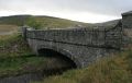
 New Cock Bridge - Geograph - 879475.jpg 640 × 480; 63 KB
 Old and New - Geograph - 281630.jpg 640 × 480; 90 KB
 PC290004.JPG 1,716 × 1,287; 873 KB
 Snowy A939.jpg 2,128 × 1,416; 661 KB
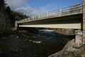
 The A93 And The Bridge Over Clunie Water.jpg 2,000 × 1,500; 2.22 MB
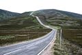
 The A93 stretches out - Coppermine - 22438.jpg 3,008 × 2,000; 2 MB
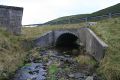
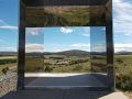 View through the box at The Still Viewpoint - Geograph - 5845048.jpg 640 × 480; 69 KB


.jpg)


