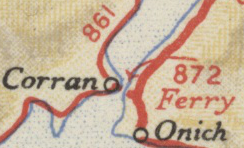
File:A872 (Corran Ferry).png

From Roader's Digest: The SABRE Wiki
Jump to navigation Jump to search

A872_(Corran_Ferry).png(244 × 148 pixels, file size: 78 KB, MIME type: image/png)

Y topleft.gifY topright.gif
Description:Original A872 by Corran Ferry This page contains scans from a map that is believed may be out of copyright according to UK Crown Copyright, UK Copyright Law for other maps published in the United Kingdom, or Irish Government Copyright, is not being used to generate profit in this context, and presents information that cannot be exhibited otherwise.
If the copyright holder considers this is an infringement of their rights, please contact the site management team to discuss further steps.
Location:56.7214523, -5.2335262
Road:A872 (Corran Ferry)
Date:
Photographer:Ordnance Survey
Source:1936 Ten Mile Road Map, Sheet 1

Map

Y btmleft.gifY btmright.gif

Galleries  | A872 (Corran Ferry) | Ten-Mile Road Map of Great Britain


File history

Click on a date/time to view the file as it appeared at that time.

Date/TimeThumbnailDimensionsUserComment
current10:11, 11 November 2011Thumbnail for version as of 10:11, 11 November 2011244 × 148 (78 KB)Ritchie333 (talk | contribs)Original A872 by Corran Ferry

The following 2 pages use this file:

SABRE - The Society for All British and Irish Road Enthusiasts
Discuss - Digest - Discover - Help