
No higher resolution available.
File history
Click on a date/time to view the file as it appeared at that time.
| Date/Time | Thumbnail | Dimensions | User | Comment |
|---|
| current | 22:00, 11 April 2021 | 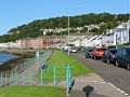 | 640 × 480 (185 KB) | Tam nugent (talk | contribs) | he path is shared by cyclists and pedestrians and forms part of National Cycle Network Route 753. |
File usage
The following page uses this file:
This file contains additional information, probably added from the digital camera or scanner used to create or digitise it.
If the file has been modified from its original state, some details may not fully reflect the modified file.
