Gallery:A26 (Isle of Man)

From Roader's Digest: The SABRE Wiki
Jump to navigation Jump to search
A Roads in the Isle of Man > A26 (Isle of Man)


This gallery has no child categories
A26 (Isle of Man)
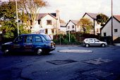
 
 
Ballasalla - A7 and A26 roundabout - Geograph - 1664598.jpg
Ballasalla - A7 and A26 roundabout
Ballasalla Roundabout - Geograph - 1979989.jpg
Ballasalla Roundabout
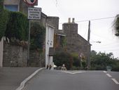
A26, approaching St Mark's - Geograph - 1845732.jpg
A26, approaching St Mark's
A26, between Braaid and St Mark's - Geograph - 1845723.jpg
A26, between Braaid and St Mark's
A26, Braaid (C) Chris Gunns - Geograph - 1845708.jpg
A26, Braaid (C) Chris Gunns
A24 Foxdale Road, Braaid (C) Chris Gunns - Geograph - 1845698.jpg
A24 Foxdale Road, Braaid (C) Chris Gunns
St Marks Road (C) Anne and Jeff Rolfe - Geograph - 1957513.jpg
St Marks Road (C) Anne and Jeff Rolfe
A26 towards Ballasalla
A26 junction with Blackboards, or Orrisdale Road - Geograph - 1845748.jpg
A26 junction with Blackboards, or Orrisdale Road
B35-st-marks.jpg
The B35 approaching St Marks Junction
A26-glen-vine.jpg
The A26 heading south across the River Dhoo from Glen Vine
 

SABRE - The Society for All British and Irish Road Enthusiasts
Discuss - Digest - Discover - Help