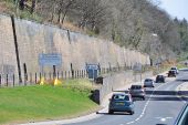
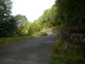
Gallery:A7

From Roader's Digest: The SABRE Wiki
Jump to navigation Jump to search
A1-A99 > A7


This gallery has no child categories
A7
 
 
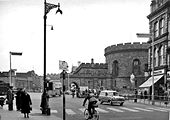
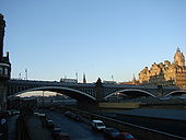
North Bridge, Edinburgh - Geograph - 637884.jpg
North Bridge, Edinburgh
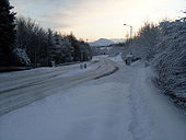
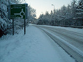
A6091 - Coppermine - 23802.jpg
A6091

Heavy lying snow on A6091, no traffic at 4pm 06/01/10

Originally uploaded to Coppermine on Jan 06, 2010 by Hagbard
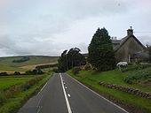
A7 at Harker.jpg
A7 at Harker
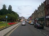
Albert Street, Longtown (A6071) - Geograph - 1414044.jpg
Albert Street, Longtown (A6071)
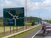
A720 - Edinburgh City Bypass - Coppermine - 14485.jpg
A720 - Edinburgh City Bypass

Sheriffhall roundabout coming from the A7, a bottleneck on the A720 made worse because of a truck crash on this occasion.

Originally uploaded to Coppermine on Aug 02, 2007 by Kenny1975
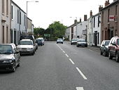
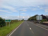
B6318A7.jpg
B6318 meets the A7
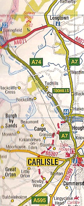
Carlisle's road schemes - Coppermine - 6938.png
Carlisle's road schemes

Western Bypass and Cumberland Gap proposed in the 2007 AtoZ GB Atlas Originally uploaded to Coppermine on Jul 26, 2006 by sabristo simon

This page includes a scan of a non-free copyrighted map, and the copyright for it is most likely held by the company or person that produced the map. It is believed that the use of a limited number of web-resolution scans qualifies as fair use under United States copyright law, where this web page is hosted, as such display does not significantly impede the right of the copyright holder to sell the copyrighted material, is not being used to generate profit in this context, and presents information that cannot be exhibited otherwise.
If the copyright holder considers this is an infringement of their rights, please contact the Site Management Team to discuss further steps.

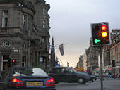
Carlisle city centre - Geograph - 1731484.jpg
Carlisle city centre
Northward at Botchergate; Court House to right.
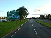
Greymoorhill Roundabout A7 - Coppermine - 14661.jpg
Greymoorhill Roundabout A7

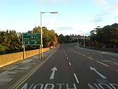
Coming up to Greymoorhill Roundabout also known as jct 44 of the M6.

Originally uploaded to Coppermine on Aug 08, 2007 by Kenny1975
Hub, Edinburgh - Coppermine - 6529.jpg
A1/A7/A8/ hub, Edinburgh

Waterloo Place (A1), North Bridge (A7), Princes Street (A8), Leith Street (A900): looking west. Waverley Station is on the left

Originally uploaded to Coppermine on Jun 23, 2006 by Simon A6(M)
At the old GPO in Edinburgh. - Coppermine - 2057.jpg
At the old GPO in Edinburgh.

The photo's taken facing south. To the south east lies the 6 zone, to the south west the 7 zone, over the photographer's right shoulder the 8/9 zone and over the left shoulder the 1 zone.

Originally uploaded to Coppermine on May 05, 2005 by A68Nick
Snowbound A7 - Coppermine - 23803.jpg
Snowbound A7

A7 looking SE to Kingsknowes roundabout,9am 06/01/10. It should be nose to tail...

Originally uploaded to Coppermine on Jan 06, 2010 by Hagbard
08 - Coppermine - 19159.jpg
Auchenrivock 01/07/08

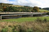
New alignment in a cutting which emerges just below the notch in the horizon. This is where the existing road was undermined by the River Esk which flows parallel to the road on the left.

Originally uploaded to Coppermine on Jul 22, 2008 by Hagbard
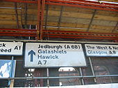
A7 Just north of Galashiels - Coppermine - 14515.jpg
A7 Just north of Galashiels Originally uploaded to Coppermine on Aug 03, 2007 by Kenny1975
A7 Galashiels - Coppermine - 14516.jpg
A7 Galashiels Originally uploaded to Coppermine on Aug 03, 2007 by Kenny1975
A7 - Coppermine - 14517.jpg
A7

Galashiels

Originally uploaded to Coppermine on Aug 03, 2007 by Kenny1975
A7 - Coppermine - 14514.jpg
A7

Edinburgh 11miles

Originally uploaded to Coppermine on Aug 03, 2007 by Kenny1975
A7 Newbattle - Coppermine - 14513.jpg
A7 Newbattle

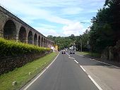
Viaduct on the A7 near Edinburgh

Originally uploaded to Coppermine on Aug 03, 2007 by Kenny1975
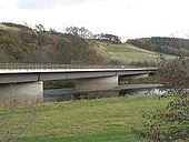
New Tweed Bridge - Geograph - 624075.jpg
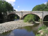
New Tweed Bridge
Once the A7 used two bridges, one over the Tweed and another over the Ettrick. Now replaced by a new bridge over the Tweed just below the confluence.
Skipper's Bridge - Geograph - 1383479.jpg
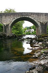
Skipper's Bridge
The bridge carries the A7 across the River Esk just south of Langholm. It was not built for modern traffic, and a set of traffic lights controls its use. This view is looking upstream towards Langholm.
A7 Roadbridge over River Eden in Carlisle - Geograph - 92889.jpg
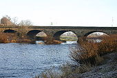
A7 Roadbridge over River Eden in Carlisle
Currently the only road crossing of the river within the city
Sheriffhall Roundabout - Geograph - 28770.jpg
Sheriffhall Roundabout
Build a motorwayish road to bypass a major city. Invite lots of traffic, and stick a roundabout in the middle, with traffic lights!
A piece of costcutting from the 1980's and a guaranteed queue. Three busy roads all cross here. The reason for the lack of a split level junction here was that it was considered too expensive to make safe the mine workings under the site. Without remedial work, the ground cannot support the weight of a bridge.
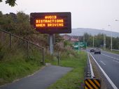
NetherbarnsVMS.jpg
Ironic VMS message
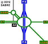
Kingstown Interchange 2012.png&-8206;.png
kingstown Interchange as it is now.
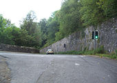
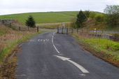
Abandoned A7.jpg
Abandoned A7 south of Selkirk
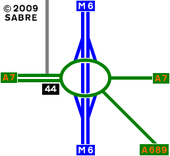
Kingstown Interchange.png
Kingstown Interchange as it is was in 2008.
Selkirk - Flickr - 9127117364.jpg
The A7 road in Selkirk
Old Tweed Bridge (C) Iain Lees - Geograph - 749974.jpg
Old Tweed Bridge (C) Iain Lees
Opened by Sir Walter Scott
Ettrick Bridge spanning the Ettrick... (C) Walter Baxter - Geograph - 207475.jpg
Ettrick Bridge spanning the Ettrick... (C) Walter Baxter
A7tweed-br.jpg
The new Tweed Bridge across the River Tweed near Galashiels
Branxholme-br-plaque.jpg
Plaque on Branxholme Bridge over the River Teviot on the A7
Branxholm-br1.jpg
Branxholm Bridge over the River Teviot on the A7, showing the stepped arch ribs to provide the skew
Teindside-br1.jpg
Teindside Bridge, spanning the River Teviot on the A7 near Teviothead
Teindside-br2.jpg
Looking across Teindside Bridge, spanning the River Teviot on the A7 near Teviothead
Teindside3.jpg
Looking north up the A7 from Teindside Bridge. The patch of tarmac on the extreme left is the old A7 line, leading to the predecessor to the modern bridge.
Hawick-nbr-rbt.jpg
North Bridge Roundabout in Hawick, where the A698 terminates on the A7
Hawick-albt-br1.jpg
Albert Bridge in Hawick, carrying the A7 across the Teviot
Drumlarig-br-plaque.jpg
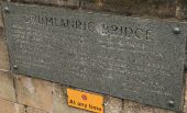
Plaque on the parapet of Drumlanrig Bridge in Hawick
Drumlanrig-br.jpg
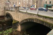
Drumlanrig Bridge in Hawick
B709pw-langholm.jpg
Patched Pre-Worboys Sign on the B709 in Langholm. The patch replaces the A709 which used to extend into Langholm from Lockerbie.
A7pw-langholm.jpg
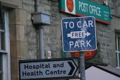
Pre Worboys Car Park sign on the A7 in Langholm
Princes Street, Edinburgh - Coppermine - 6476.jpg
Princes Street, Edinburgh

The start (or end) of the A1/A7 - both non-primary for a short while.

Originally uploaded to Coppermine on Jun 21, 2006 by Simon A6(M)
Eden Bridge Carlisle - Coppermine - 14662.jpg
Eden Bridge Carlisle Originally uploaded to Coppermine on Aug 08, 2007 by Kenny1975
The A7 at Middleton Moor - Geograph - 3945911.jpg
The A7 at Middleton Moor With a profusion of signs - seventeen in total - county boundary; road junction signs; bus stop; warnings; Borders Railway contractor signs; and tourist information. Looking from The Scottish borders into Midlothian - the boundary is the Cakemuir Burn, which runs under the road along the line of the hedge at the left.
A720 final sections.jpg
The Final sections of the A720 under construction from 1990.
South Bridge - Geograph - 3652455.jpg
South Bridge Looking eastwards along Cowgate under the bridge. Built 1786-1788, now listed category B (ref. 27950).
A7 Ladhope Vale and the Borders Railway, Galashiels - Geograph - 3414150.jpg
A7 Ladhope Vale and the Borders Railway, Galashiels Work has started on the old Waverley Line (in view here on the left) to re-lay track from Edinburgh to Tweedbank. The sign on the left gives notice of advance works on the Borders Railway.
The Old A7 at Byreburnfoot - Geograph - 3727569.jpg
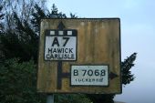
The Old A7 at Byreburnfoot The road became the B7201 in 1984, when the Canonbie bypass was opened. 18 months later it was closed to motor traffic after a landslip took away part of the northbound carriageway.
 
 
Page 1, 48 file(s) of 51 shown
Page 1 2

SABRE - The Society for All British and Irish Road Enthusiasts
Discuss - Digest - Discover - Help