Gallery:A8 (Northern Ireland)
From Roader's Digest: The SABRE Wiki
Jump to navigation
Jump to search
A1-A99 (Northern Ireland) > A8 (Northern Ireland)
This gallery has no child categories
A8 (Northern Ireland)
TO AND FROM THE FERRIES AT LARNE
The Harbour Highway is the Larne bypass on the A8 from Belfast. There is about another mile (and two roundabouts) before the harbour. The harbour is to the right. 7 March 2007.
Originally uploaded to Coppermine on Mar 07, 2007 by Wee HughieNORTH FROM CORR'S CORNER
The road to Larne leaves the M2 at Sandyknowes roundabout and become the A8(M) for a short distance to Corr's Corner roundabout. After that it becomes the A8 (under the local name of the 'Larne line'). This is the view from Corr's Corner roundabout to Coleman's Corner roundabout with Houston's Corner roundabout in the middle. (There are another five roundabouts before the road reaches the harbour at Larne). The road is a mixture of dual carriageway, single carriageway and 2+1.
Originally uploaded to Coppermine on Jan 26, 2007 by Wee HughieThe Harbour Highway, Larne
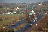
The Harbour Highway connects Larne harbour to the Belfast road. The view is towards the harbour with the Redlands roundabout (�Harbour Highway roundabout� on the Google map) at top left.
The Harbour Highway connects Larne harbour to the Belfast road. The view is towards the harbour with the Redlands roundabout (�Harbour Highway roundabout� on the Google map) at top left.
Elevated road, Larne
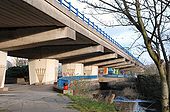
Part of the Harbour Highway is elevated as it bypasses the centre of Larne. The view is towards the harbour with the River Inver on the right.
Part of the Harbour Highway is elevated as it bypasses the centre of Larne. The view is towards the harbour with the River Inver on the right.
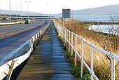
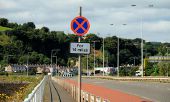
'Clearway' sign, Larne
