Gallery:Ellesmere Port

From Roader's Digest: The SABRE Wiki
Jump to navigation Jump to search
Places in the North West > Ellesmere Port


This gallery has no child categories
Ellesmere Port
 
 
Hooton Industrial Road now M53 at junction 6 - Geograph - 6434186.jpg
The M53 at junction 6 on the Hooton Industrial Road
Cheshire Improvement Schemes May 1966 map Chester and South Wirral
Improvement Schemes map prepared by Cheshire County Surveyor May 1966
Cheshire Area Road Network Outline Proposals 16 Jan 1970.jpg
A plan of the Chester and South Wirral road proposals at January 1970.

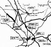
Key: Solid line = roads under construction or complete Dashed line = in planning pool Black dotted line = future government scheme

White dotted line = future County schemes
 

SABRE - The Society for All British and Irish Road Enthusiasts
Discuss - Digest - Discover - Help