Gallery:Roadside Inn

From Roader's Digest: The SABRE Wiki
Jump to navigation Jump to search
Road Features > Roadside Inn


This gallery has no child categories
Roadside Inn
 
 
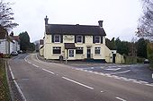
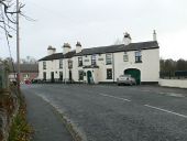
B3110-george-inn.jpg
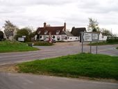
The George Inn at the junction with the B3110 and A366 in Norton St Philip
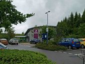
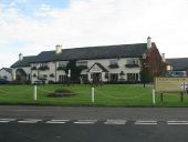
Travelodge, Broxden - Geograph - 2340224.jpg
Travelodge, Broxden
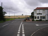
Passing the Plough Inn - Geograph - 991938.jpg
Passing the Plough Inn
Carbeth Inn, Stirlingshire - Geograph - 53600.jpg
Carbeth Inn, Stirlingshire
Premier Travel Inn M3 southbound - Geograph - 853999.jpg
Premier Travel Inn M3 southbound
The Staghead Inn and crossroads - Geograph - 927954.jpg
The Staghead Inn and crossroads
The Gaydon Inn - Coppermine - 14029.jpg
The Gaydon Inn

Presumably an old coaching Inn?

Originally uploaded to Coppermine on Jul 18, 2007 by leopard680
A30 Inn - Coppermine - 23102.jpg
A30 Inn

There is a build out here, to increase sightlines for a side turning. A local watching the fun, related how the King Arms Inn on the right, used to open at 5.30am on summer Saturdays for breakfasts and, would be full by 6am.

Originally uploaded to Coppermine on Sep 12, 2009 by SteveA30
A38 Dobwalls, Highwayman Inn - Coppermine - 14991.jpg
A38 Dobwalls, Highwayman Inn

Looking west by a dangerous location in bygone times, if the sign is true.

Originally uploaded to Coppermine on Aug 26, 2007 by SteveA30
The Chequers Inn, Goudhurst - Geograph - 1593603.jpg
The Chequers Inn, Goudhurst
Killingworth Castle Inn, Wootton - Geograph - 1117439.jpg
Killingworth Castle Inn, Wootton
Croxdale Inn Hotel - Geograph - 408649.jpg
Croxdale Inn Hotel
On Front Street, Croxdale (B6288).
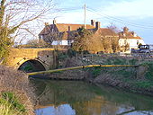
The Ferry Inn - Geograph - 388580.jpg
The Ferry Inn
The road is Appledore Road, the principal road into the Isle of Oxney from the north. The watercourse is called the Reading Sewer. Originally it was much wider and part of the River Rother which flowed north of Oxney. However, according to this <a title='http://www.villagenet.co.uk/history/0000-romneymarsh.html' rel='nofollow' href='http://www.villagenet.co.uk/history/0000-romneymarsh.html'>Link</a><img style='padding-left:2px;' alt='External link' title='External link - shift click to open in new window' src='http://s0.geograph.org.uk/img/external.png' width='10' height='10'/> the Rother was flowing south of Oxney as early as 1750. The pub is called the Ferry Inn and outside it is a board headed 'Oxney Ferry, List of Tolls' and including 'Motor coach or Char-a-banc - 1s 6d' suggesting that it was still a ferry in the age of the motor car. Given the narrowness of the river why did nobody build a bridge sooner? Or was it in fact a toll bridge?


(e-mailed information from a visitor to the site follows)

I noticed your note about the Ferry. The Ferry is located at the last land spit on the Isle of Oxney, which used to be surrounded by sea and rivers, and much of the surrounding area became marshland in around 1650, when the sea level changed. The ferry used to carry people from the Isle of Oxney to the mainland at Appledore, a journey of over a mile.

The river Rother used to run past the pub, but was later diverted to the other side of the island. This was a major transport route for shipping, as it used to run from Newenden past Smallhythe (both major ship-building ports in Henry VIII's day) to the port at Rye. Currently, the waterway that runs past the Ferry is called Reading Sewer.

More info is available on the ferry website at <a title='www.oxneyferry.com' rel='nofollow' href='http://www.oxneyferry.com'>Link</a><img style='padding-left:2px;' alt='External link' title='External link - shift click to open in new window' src='http://s0.geograph.org.uk/img/external.png' width='10' height='10'/>
Darlaston Inn - Geograph - 5234.jpg
Darlaston Inn
Situated in the centre o a roundabout just outside of stone.
The Plough Inn, Radwinter - Geograph - 161801.jpg
The start of the B1054 by the Plough Inn, Radwinter
The Marlbank Inn - Geograph - 427560.jpg
The Marlbank Inn
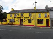
Pettigo Inn, Pettigo - Geograph - 2072306.jpg
The Pettigo Inn is located in Main Street, Pettigo
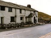
Kirkstone Pass Inn - Geograph - 575323.jpg
Kirkstone Pass Inn on the A592, as it was in 1983.
The Battery Inn - Geograph - 363358.jpg
The Battery Inn
The Battery Inn - Geograph - 708790.jpg
The Battery Inn
The Grosvenor Inn (C) Glyn Baker - Geograph - 3406084.jpg
The Grosvenor Inn (C) Glyn Baker
A good stop for a pint and a bite to eat <a title='http://grosvenor.im/location.php' rel='nofollow' href='http://grosvenor.im/location.php'>Link</a><img style='padding-left:2px;' alt='External link' title='External link - shift click to open in new window' src='http://s1.geograph.org.uk/img/external.png' width='10' height='10'/> The road is the A17
New Inn, County Galway - Geograph - 1853090.jpg
New Inn, County Galway, on the R348
'The Bell' inn, Burford Street,... (C) Robert Edwards - Geograph - 1480834.jpg
'The Bell' inn, Burford Street,... (C) Robert Edwards
This building dates back to the 16th century.
Great North Road dualling - Coppermine - 15991.jpg
Great North Road dualling

This pic taken in the 1950s (not by me!) shows the dualling under construction at the far right of the pic. The building is the well known Ram Jam Inn.

from Webster.

Originally uploaded to Coppermine on Nov 17, 2007 by Lonewolf
Victoria - Coppermine - 12038.jpg
Victoria

Looking east through Victoria. On a motorbike ride from Fleet to Penzance in 1977, I met another biker at the Little Chef at Honiton and, we rode west together, stopping at this Inn for a lovely Cornish pasty and cold beverage. How many memories from countless journeys have passed into history, along with the road.

Originally uploaded to Coppermine on May 21, 2007 by SteveA30
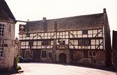
Image243 - St Lawrence Inn, Ventnor Isle of Wight 50.5852023N 1.2478928W.jpg
St Lawrence Inn, Ventnor, Isle of Wight - Early 1970s
The Loo Bridge Inn - Geograph - 575308.jpg
The Loo Bridge Inn By the R569 west of Clonkeen, Co. Kerry.
Catchems Inn - Geograph - 1306860.jpg
Catchems Inn On Hearthcote Road, Church Gresley.
New Mermaid Inn - Geograph - 1209292.jpg
New Mermaid Inn This Art Deco building was originally constructed to replace a pub, Ye Olde Mermaide Inn located at the cross roads in the village. The problems of Heavy traffic in 1937 forced its demolition The new pub was built beside the recently constructed Wansford by-pass, it then became a Little Chef and is now vandalised. Not much change, a bit more tagging, no for sale signs so a rather miserable state of affairs.
Sibson Inn, A1 - Geograph - 2621777.jpg
Sibson Inn, A1
The Victoria Inn, Glasson - Geograph - 2435417.jpg
The Victoria Inn, Glasson A pub with a decided maritime air as befits one next to Glasson Dock.
The Cock Inn, Hockerill - Geograph - 4422736.jpg
'The Cock Inn', Hockerill Grade II listed building, described at this http://list.historicengland.org.uk/resultsingle.aspx?uid=1102415.
New Inn, St Asaph - Geograph - 607768.jpg
New Inn, St Asaph On Lower Denbigh Road, St Asaph
Cluster of buildings around the Peacock Inn, Owler Bar - Geograph - 2437515.jpg
Cluster of buildings around the Peacock Inn, Owler Bar The Peacock Inn is set above a memorable road junction with an egg-timer shaped elongated "roundabout" with five exits at the edge of the moorland.
The Fox House Inn - Geograph - 2643803.jpg
The Fox House Inn
Ralegh's Cross Inn - Geograph - 2076095.jpg
Ralegh's Cross Inn from the B3190 / B3224 junction
The Rest and be thankful Inn,Wheddon Cross - Geograph - 1765267.jpg
The Rest and be thankful Inn, Wheddon Cross looking along the A396
Crown Inn - Geograph - 2989413.jpg
Crown Inn
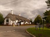
Furzehill- the Stocks Inn - Geograph - 1405757.jpg
Furzehill- the Stocks Inn A picturesque thatched pub by the village crossroads. To the right, we see the signpost which retains its original finial, giving location (Colehill - Stocks Cross) and grid reference.
 

SABRE - The Society for All British and Irish Road Enthusiasts
Discuss - Digest - Discover - Help