Gallery:S1
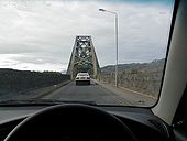
Driving over the Connel Bridge towards Fort William. Connel Bridge has had an odd history. From soon after its construction road vehicles were sometimes carried across on a railway wagon. In 1914 it was converted to allow road vehicles to drive over it, and for the next 50 years the bridge was used by both road and rail traffic. This stopped with the closure of the Ballachulish Branch Railway in 1966, and since then the bridge has been used exclusively by road traffic, controlled through the narrow roadway by traffic lights.
Originally uploaded to Coppermine on Nov 27, 2006 by BelnahuaThe A838 heads south down the west coast of Scotland. No traffic lights or roundabouts in sight.
Originally uploaded to Coppermine on Apr 03, 2008 by TSMidway along the north Scottish coast
Originally uploaded to Coppermine on Apr 03, 2008 by TSLooking west where the A830 narrows to S1 between Lochailort and Arisaig, and now consigned to history.
Originally uploaded to Coppermine on Mar 06, 2007 by HagbardA single track road running from the A816 alongside Loch Awe. The A816 was closed due to an accident so traffic was diverted off along this road, two vans met and one drove into a ditch. Here the one in front is trying to drag out the one behind.
Originally uploaded to Coppermine on Jul 27, 2006 by Mark HewittA970 Isbister looking northwards. This is the northern most end of the road. A track continues over the hills through a croft in the distance.
Originally uploaded to Coppermine on Dec 09, 2009 by loch_cuan73A970 Isbister looking southwards close to most northerly end of road
Originally uploaded to Coppermine on Dec 09, 2009 by loch_cuan73This part of the A960 through Kirkwall is one-way and partly pedestrianised.
OP David D Miller
Originally uploaded to Coppermine on Apr 17, 2005 by M4SimonWho needs Wig-Wags!
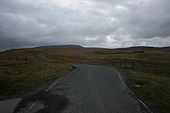
Originally uploaded to Coppermine on Apr 03, 2009 by J--M--BOn the pass on the Quairing road between Uig & Staffin on Skye
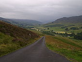
Originally uploaded to Coppermine on Nov 02, 2008 by TomThe road from Glen Quaich to Kenmore, looking back down Glen Quaich
Originally uploaded to Coppermine on Jul 31, 2008 by A8000_BobThe road into Plockton from the North
Originally uploaded to Coppermine on Jul 31, 2008 by A8000_BobThe Road into Plockton from the North
Originally uploaded to Coppermine on Jul 31, 2008 by A8000_BobSuspected to be Glen LyonOriginally uploaded to Coppermine on Jul 29, 2008 by A8000_Bob
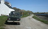
This is the road on Canna, the island is owned by the National Trust for Scotland so it will be noticed that the Land Rover has no road tax. The road runs from the pier around the bay, it comes to a gate where it goes either through a farmyard or over the beach.
I did notice that the surface is smoother than the A82 North of Tarbet!
Originally uploaded to Coppermine on Apr 18, 2008 by J--M--BThis is the road on Canna, the island is owned by the National Trust for Scotland. The road runs from the pier around the bay, it comes to a gate where it goes either through a farmyard or over the beach.
I did notice that the surface is smoother than the A82 North of Tarbet!
Originally uploaded to Coppermine on Apr 18, 2008 by J--M--BPassing place on the temporary route
Originally uploaded to Coppermine on Jul 01, 2007 by GlenPassing places on the temporary route.
Originally uploaded to Coppermine on Jul 01, 2007 by GlenThis is the most westerly point of Great Britain's road network. Photo taken April 1991. Pre-warboys 'END of public road' sign. Private road carries on to the lighthouse. There are now traffic lights controlling the onward road.
Originally uploaded to Coppermine on Jun 15, 2007 by HagbardQuite a climb on Raasay
Originally uploaded to Coppermine on Jun 06, 2007 by NwallaceWhat this picture doesn't show is the drop that is just round the corner
Originally uploaded to Coppermine on Jun 06, 2007 by NwallaceThere were lots of Police Notices asking that you allow overtaking by pulling into passing places, which is always a good thing (o:
Originally uploaded to Coppermine on Jun 30, 2005 by c2ROP J-M-B
Originally uploaded to Coppermine on Apr 06, 2005 by M4SimonOP J-M-B
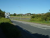
Originally uploaded to Coppermine on Apr 06, 2005 by M4SimonNorthbound on-slip at the grade-separated junction between B149 and Old Dock Approach Road.
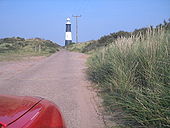
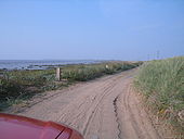
Originally uploaded to Coppermine on Jun 04, 2006 by Sunil_of_YoxleyOr rather the road from Spurn. This is facing north from the end of Spurn head. There is a 'car park' (rubble dropped onto a beach) to our left which is as far as the public can go - there is a dock slightly further out behind us. In front is Spurn head lighthouse, which you can see as a dot on the horizon from the mainland.
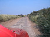
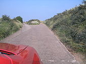
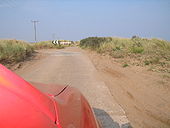
Originally uploaded to Coppermine on Sep 25, 2005 by Roadtripper_IanJust after leaving the end of the head we plunge through sand dunes which spread themselves over a dozen or so feet on either side.
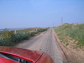
Originally uploaded to Coppermine on Sep 25, 2005 by Roadtripper_IanA quick shimmy to the west around a section which as disappeared under the dunes.
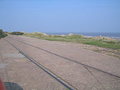
Originally uploaded to Coppermine on Sep 25, 2005 by Roadtripper_IanThere used to be a tramway down the spit, most of which is now completely buried under the sand dunes. Every now and then rails emerge, cross the road, and promptly disappears again
Originally uploaded to Coppermine on Sep 25, 2005 by Roadtripper_IanThe first major diversion, where I presume the old road has been buried by the sand. Its a sharp left turn with a blind brow and a steep hill. Had fun reversing up it shortlay after taking the picture.
Originally uploaded to Coppermine on Sep 25, 2005 by Roadtripper_IanIts much steeper than it looks!
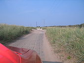
Originally uploaded to Coppermine on Sep 25, 2005 by Roadtripper_IanThe diversion rejoins the old track (just visible joining to our right in the distance) before diving off it again.
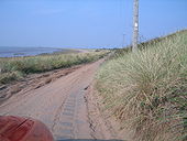
Originally uploaded to Coppermine on Sep 25, 2005 by Roadtripper_IanThe track runs along the western coast - the eastern coast is all of 10 feet away over the dunes to our right.
Originally uploaded to Coppermine on Sep 25, 2005 by Roadtripper_Ian
