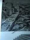
Holborn Viaduct
Jump to navigation
Jump to search
| Holborn Viaduct | |||
| Location Map ( geo) | |||
 | |||
| |||
| From: | City Thameslink Railway Station | ||
| To: | Holborn Circus | ||
| Location | |||
| NY345656 | |||
| County | |||
| Middlesex | |||
| Highway Authority | |||
| City of London | |||
| Opening Date | |||
| 1869 | |||
| Additional Information | |||
| |||
| On road(s) | |||
| A40 | |||
Holborn Viaduct is the City of London's sole viaduct over another road, carrying the A40 Holborn Viaduct over the A201 Farringdon Street and also over the subterranean River Fleet. It was built between 1863 and 1869 at a cost of £2M.
Structural Form
The viaduct is a 3-span cast iron girder bridge supported by granite piers. Originally there were four large houses, one on each corner of the bridge but only two these now survive. There are staircases within these buildings to allow pedestrians to walk from Farringdon Street to Holborn Viaduct and vice versa.
| Holborn Viaduct | ||
|


