File:1970 Strip Map of the A74 I - Coppermine - 2243.JPG
Jump to navigation
Jump to search

Size of this PNG preview of this JPG file: 199 × 600 pixels.
Original file (437 × 1,317 pixels, file size: 1.65 MB, MIME type: image/x-ms-bmp)
| ||||||||||||||
|
Galleries | A74 | M6 | Cumberland Gap | ||
File history
Click on a date/time to view the file as it appeared at that time.
| Date/Time | Thumbnail | Dimensions | User | Comment | |
|---|---|---|---|---|---|
| current | 19:34, 3 March 2011 | 437 × 1,317 (1.65 MB) | Abeaton (talk | contribs) | ||
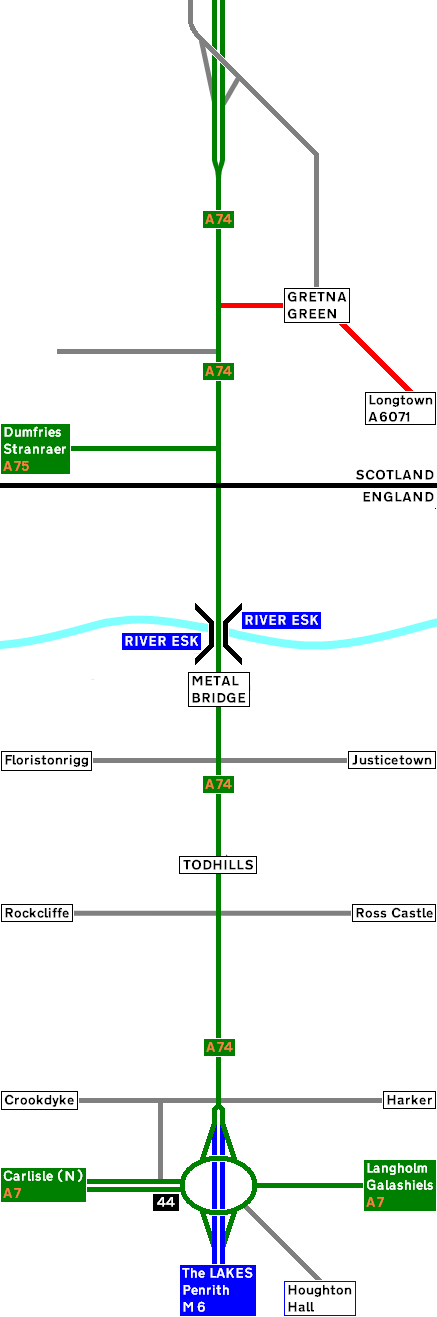
| 17:45, 31 March 2010 | 290 × 743 (38 KB) | Rileyrob (talk | contribs) | '''1970 Strip Map of the A74 I''' Here is the A74 before the M6 opened. Traffic is now using the roundabout that will become M6 J44 <small>''Originally uploaded to Coppermine on May 16, 2005 by ABeaton''</small> |
File usage
There are no pages that use this file.