File:Campbeltown- Northern Ireland destinations - Geograph - 3286698.jpg
Jump to navigation
Jump to search

No higher resolution available.
Campbeltown-_Northern_Ireland_destinations_-_Geograph_-_3286698.jpg (640 × 481 pixels, file size: 49 KB, MIME type: image/jpeg)
| |||||||||||||||||||||||||
|
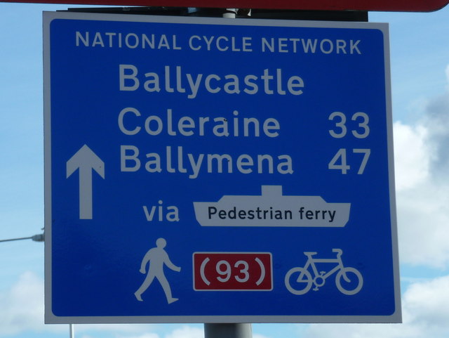
Galleries | NCN93 | Ballycastle - Campbeltown ferry | Campbeltown | ||
File history
Click on a date/time to view the file as it appeared at that time.
| Date/Time | Thumbnail | Dimensions | User | Comment | |
|---|---|---|---|---|---|
| current | 09:20, 18 August 2018 | | 640 × 481 (49 KB) | C2r (talk | contribs) | '''Campbeltown- Northern Ireland destinations''' The National Cycle Network sign gives distances to three Northern Irish towns, thanks to the existence of a passenger ferry. |
File usage
The following 2 pages use this file: