Gallery:Douglas

From Roader's Digest: The SABRE Wiki
Jump to navigation Jump to search


This gallery has no child categories
Douglas
 
 
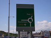
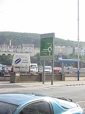
Roadsign in Douglas - Coppermine - 21231.JPG
Roadsign in Douglas

Note that 'Castletown' is on a rotating prism. I'm not quite sure why, perhaps if there's a problem with the swing bridge.

Originally uploaded to Coppermine on Jan 20, 2009 by Danno B10M
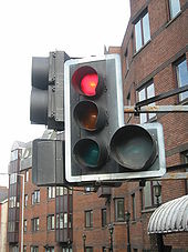
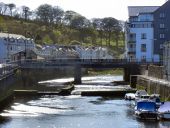
Douglas Harbour Swing Bridge - Coppermine - 21230.JPG
Douglas Harbour Lifting Bridge Originally uploaded to Coppermine on Jan 20, 2009 by Danno B10M
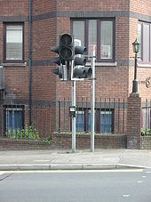
Douglas Harbour Swing Bridge - Coppermine - 21229.JPG
Douglas Harbour Lifting Bridge Originally uploaded to Coppermine on Jan 20, 2009 by Danno B10M
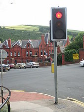
Douglas Harbour Swing Bridge - Coppermine - 21228.JPG
Douglas Harbour Lifting Bridge Originally uploaded to Coppermine on Jan 20, 2009 by Danno B10M
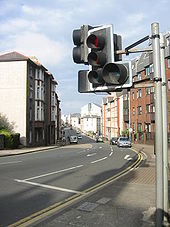
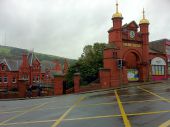
IOM Douglas Railway Station Mellors - Coppermine - 13395.JPG
IOM Douglas Railway Station Mellors

View of signal head that has a raised ped signal to clear nrt box below it.

Originally uploaded to Coppermine on Jun 26, 2007 by FreddyTheFrog
IOM Douglas Railway Station Mellors - Coppermine - 13394.JPG
IOM Douglas Railway Station Mellors

Other view of signal head that has a raised ped signal to clear nrt box below it.

Originally uploaded to Coppermine on Jun 26, 2007 by FreddyTheFrog
IOM Douglas Railway Station Mellors - Coppermine - 13393.JPG
IOM Douglas Railway Station Mellors Originally uploaded to Coppermine on Jun 26, 2007 by FreddyTheFrog
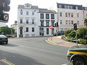
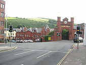
IOM Douglas Railway Station Mellors - Coppermine - 13392.JPG
IOM Douglas Railway Station Mellors

View towards railway station

Originally uploaded to Coppermine on Jun 26, 2007 by FreddyTheFrog
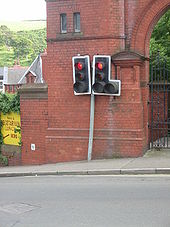
IOM Douglas Railway Station Mellors - Coppermine - 13391.JPG
IOM Douglas Railway Station Mellors

Mellor signal heads with railway station behind. Post has been hit and is bent backwards towards wall.

Originally uploaded to Coppermine on Jun 26, 2007 by FreddyTheFrog
IOM Douglas Railway Station Mellors - Coppermine - 13389.JPG
IOM Douglas Railway Station Mellors Originally uploaded to Coppermine on Jun 26, 2007 by FreddyTheFrog
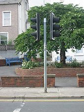
IOM Douglas Railway Station Mellors - Coppermine - 13388.JPG
IOM Douglas Railway Station Mellors

Signal head. Ped signals are raised to sit above NRT box.

Originally uploaded to Coppermine on Jun 26, 2007 by FreddyTheFrog
IOM Douglas Railway Station Mellors - Coppermine - 13386.JPG
IOM Douglas Railway Station Mellors

Railway station is to the left of this picture.

Originally uploaded to Coppermine on Jun 26, 2007 by FreddyTheFrog
IOM Route Sign For A1 - Coppermine - 13309.JPG
IOM Route Sign For A1

Sign near Douglas centre and ferry terminal.

Originally uploaded to Coppermine on Jun 24, 2007 by FreddyTheFrog
IOM Douglas Lord Street Crossing - Coppermine - 13277.JPG
IOM Douglas Lord Street Crossing Originally uploaded to Coppermine on Jun 24, 2007 by FreddyTheFrog
The Old and The New - Geograph - 783654.jpg
The Old and The New
An old horse drawn tram mingles with a modern omnibus.
The TT Grandstand Area - Isle of Man - Geograph - 31739.jpg
The TT Grandstand Area - Isle of Man
This was taken from the footbridge over the course during one of the races in the 2004 festival. The actual grandstand is just about out of shot to the right, but the track and pit areas are visible.
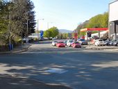
Lord St. roundabout in Douglas - Geograph - 108432.jpg
Lord St. roundabout in Douglas
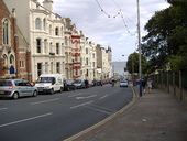
Douglas , Lord Street - Geograph - 478051.jpg
Douglas , Lord Street
Prospect Hill, Douglas - Geograph - 2387145.jpg
Prospect Hill, Douglas
Prospect Hill - Geograph - 2387165.jpg
Prospect Hill
Harris Promenade, Douglas - Geograph - 2145300.jpg
Harris Promenade, Douglas
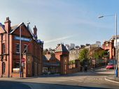
Douglas Railway Station, Bank Hill - Geograph - 2387057.jpg
Douglas Railway Station, Bank Hill
Buck's Road, Douglas - Geograph - 1883838.jpg
Buck's Road, Douglas
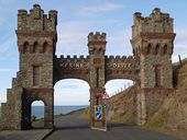
Gate - Marine Drive. Isle of Man - Geograph - 32197.jpg
Gate - Marine Drive. Isle of Man
Broadway, Douglas, Isle of Man - Geograph - 227545.jpg
Broadway, Douglas, Isle of Man
Buck's Road, Douglas - Geograph - 1883850.jpg
Buck's Road, Douglas
Peel Road, Douglas - Geograph - 2390070.jpg
Peel Road, Douglas
Quarterbridge Road - Geograph - 2389964.jpg
Quarterbridge Road
The Quarter Bridge public house - Geograph - 1883807.jpg
The Quarter Bridge public house
Footbridge, Glencrutchery Road - Geograph - 2389882.jpg
Footbridge, Glencrutchery Road
Kewaigue Bridge - Geograph - 24362.jpg
Kewaigue Bridge
Douglas - South Quay-Douglas Head Rd roundabout - Geograph - 1681936.jpg
Douglas - South Quay-Douglas Head Rd roundabout
Richmond Hill Rebuild (C) Anne and Jeff Rolfe - Geograph - 1956932.jpg
Richmond Hill Rebuild (C) Anne and Jeff Rolfe
Douglas over the Richmond Hill road redevelopment
A5 New Castletown Road (C) Chris Gunns - Geograph - 1845534.jpg
A5 New Castletown Road (C) Chris Gunns
A5 New Castletown Road (C) Chris Gunns - Geograph - 1845523.jpg
A5 New Castletown Road (C) Chris Gunns
Approaching the A2 junction with the A18 (C) Andrew Abbott - Geograph - 3148643.jpg
Approaching the A2 junction with the A18 (C) Andrew Abbott
In Douglas.
Mini island on the A2 (C) Andrew Abbott - Geograph - 3148648.jpg
Mini island on the A2 (C) Andrew Abbott
In Douglas.
Douglas - North Quay, Parade St roundabout - Geograph - 1714182.jpg
Douglas - North Quay, Parade St roundabout
Ballanard Road, Douglas (C) Phil Harrison - Geograph - 254248.jpg
Ballanard Road, Douglas (C) Phil Harrison
Looking Westwards towards Abbeylands
Woodbourne Road (C) Andrew Abbott - Geograph - 3148668.jpg
Woodbourne Road (C) Andrew Abbott
Douglas.
T.T. Grandstand, Douglas (C) kevin rothwell - Geograph - 227537.jpg
T.T. Grandstand, Douglas (C) kevin rothwell
The start/finish point for the T.T. Races.
The stands at the TT Start-Finish line (C) David Long - Geograph - 1728313.jpg
The stands at the TT Start-Finish line (C) David Long
The Sea Front at junction of Switzerland... (C) John Firth - Geograph - 2833342.jpg
The Sea Front at junction of Switzerland... (C) John Firth
From the horse Tram
Gateway to Learning (C) Glyn Baker - Geograph - 1821859.jpg
Gateway to Learning? (C) Glyn Baker
This is the gatehouse to the Isle of Man University Centre a business school see <a title='http://www.ibs.ac.im/' rel='nofollow' href='http://www.ibs.ac.im/'>Link</a><img style='padding-left:2px;' alt='External link' title='External link - shift click to open in new window' src='http://s1.geograph.org.uk/img/external.png' width='10' height='10'/>
Lake Road from Tesco car park (C) Anne and Jeff Rolfe - Geograph - 1974287.jpg
Lake Road from Tesco car park (C) Anne and Jeff Rolfe
Looking across Lake Road at buildings used as a Douglas Corporation depot for many years.
Bridge Over The River Douglas (C) David Dixon - Geograph - 2387051.jpg
Bridge Over The River Douglas (C) David Dixon
The bridge carrying Bridge Road over the River Glass as it enters Douglas Harbour.
Quayside Douglas (C) Henry Spooner - Geograph - 2549414.jpg
Quayside Douglas (C) Henry Spooner
Shops on the quayside, Douglas isle of Man
Douglas railway station (C) Andrew Abbott - Geograph - 3139105.jpg
Douglas railway station (C) Andrew Abbott
Isle of Man
 
 
Page 1, 48 file(s) of 131 shown
Page 1 2 3

SABRE - The Society for All British and Irish Road Enthusiasts
Discuss - Digest - Discover - Help