Douglas
| Douglas Doolish | |||
| Location Map ( geo) | |||
 | |||
| Traditional Horse Tram on the A11. | |||
| |||
| Highway Authority | |||
| Isle of Man | |||
| Forward Destination on | |||
| A1, A2, A5, A18 | |||
| Next Primary Destinations | |||
| Castletown, Onchan, Peel, Ramsey | |||
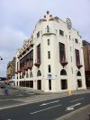
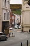
Douglas is the capital of the Isle of Man and therefore also the largest settlement, with the surrounding urban area accounting for over a third of the islands population. The town centre grew up on the north bank of the River Douglas, with a harbour developed in the river mouth, and the island's ferry port is still located in the outer harbour area. Stretching around to the north is a curved bay with a wide beach at low tide, which made Douglas a popular daytrip and holiday destination from the north west of England. Tall terraces of guest houses and hotels grew up along the wide promenade, along with a theatre and winter gardens, but never a pier. Steep hills behind the bay led to funicular cliff railways and lifts to connect the later suburbs above the shore. The town still has much of its tramway system in place, as well as the old steam railway to the south of the island, although these are now only seasonal.
Douglas expanded rapidly after the first regular steamer services brought day trippers to the island, and there is a good mix of residential, retail and industrial areas inland behind the main town centre and sea front areas. During the Twentieth Century, Douglas also became an important banking centre, due to somewhat more relaxed legislation than in the UK, and so there are now many large offices housing banking and accountancy businesses around the town centre area. This makes for a bustling shopping centre, with many large chain stores from the UK present on the main shopping streets (few have any presence elsewhere on the island). The Isle of Man Government is also based in the Tynwald buildings complex on the edge of the centre.
Roads
Douglas perhaps suffers from being in a small jurisdiction with a surplus of road numbers available. As a result, there are a huge number of very short A and B roads in the town, especially when compared to other towns of a similar size elsewhere in Britain and Ireland. No less than 18 A roads venture into Douglas itself, several of which are very short routes in the town centre which would perhaps only be B roads elsewhere, and some are really just spurs or continuations of another route. There are around 20 B roads, and the same is true, indeed a couple are effectively pedestrianised and not even worthy of being C roads, while others are very short one-way streets which serve little purpose in the movement of traffic around the town.
Two routes in particular, however, are worth noting. The A18 Mountain Road is a spectacular drive up through the mountains, passing below the summit of Snaefell, the islands highest point, to reach Ramsey and the north of the island. The other is the B80, Marine Drive, which cuts south along the cliffs before being closed to traffic due to rockfalls. However, the majority of routes out of Douglas offer something unexpected on such a relatively small island.
TT Racing
Since its inception, the TT race on the Isle of Man has passed through Douglas, and for most of its history, the start/finish line has bene in Nobles Park to the north of the town centre. Today the TT Circuit runs south along the A2 before turning west on the A1 to cross the island. It then uses the A3 to reach Ramsey, before returning to Douglas over the Mountain Road. During races, the course cuts off large parts of the island, and while a number of footbridges allow pedestrians to cross, there is only one road connection between the area inside the course and the rest of the island. This is the TT Access Road between Quarterbridge and Braddan Bridge in Douglas.
Over the years, the island has played host to many races of various classes, with a number of different circuits in use. Many of these have used parts of the main TT Circuit in and around Douglas, but none seem to be in current use.
Routes
| Route | To | Notes |
| Peel | part of TT Circuit | |
| Onchan, Laxey | part of TT Circuit | |
| Castletown | ||
| Ballasalla (A25) | forms a loop around Ballaughton and western Douglas | |
| Laxey, Ramsey | ||
| Ramsey | part of TT Circuit | |
| link from A23 to A18 to the north of Douglas | ||
| Ballanard | loops back to meet A1 at Union Mills | |
| Strang | forms a loop off A1 | |
| Foxdale | accessed via A6 | |
| Ballasalla | parallel to A5 | |
| Onchan | ||
| Onchan, Ramsey | Ramsey via A18 | |
| on A1 | ||
| on A18 | ||
| Liverpool (March to Novemember), Birkenhead (Novemember to March) | ||
| Heysham | ||
| Belfast | ||
| Dublin |


