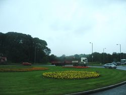
Ballygawley Roundabout
Jump to navigation
Jump to search
| Ballygawley Roundabout | |||
| Location Map ( geo) | |||
 | |||
| |||
| Location | |||
| Ballygawley | |||
| County | |||
| Tyrone | |||
| Highway Authority | |||
| DfI Roads | |||
| Junction Type | |||
| Roundabout | |||
| Roads Joined | |||
| A5 • B34 | |||
| Junctions related to the A5 (Northern Ireland) | |||
| Junctions related to the B34 (Northern Ireland) | |||
Ballygawley Roundabout was the northern end of the A4/A5 multiplex. The strategic functions have replaced by the New Ballygawley Roundabout, leaving this roundabout for local purposes.
Routes
| Route | To | Notes |
| Omagh, Londonderry | T3 | |
| Other Routes (A4), (M1) | T3 | |
| Cabragh | ||
| Ballygawley | ||
| The West, Enniskillen, Dublin, Armagh (A5) | ||
| Belfast, Dungannon |
| Ballygawley Roundabout | ||
|


