File:1991 Strip Map of the A74 I - Coppermine - 2270.JPG
Jump to navigation
Jump to search

Size of this PNG preview of this JPG file: 199 × 600 pixels.
Original file (437 × 1,317 pixels, file size: 1.65 MB, MIME type: image/x-ms-bmp)
| ||||||||||||||
|
Galleries | A74 | M6 | A74(M) | Cumberland Gap | Strip Maps | ||
File history
Click on a date/time to view the file as it appeared at that time.
| Date/Time | Thumbnail | Dimensions | User | Comment | |
|---|---|---|---|---|---|
| current | 13:40, 16 January 2012 | 437 × 1,317 (1.65 MB) | Abeaton (talk | contribs) | Updated to Modern Standards | |
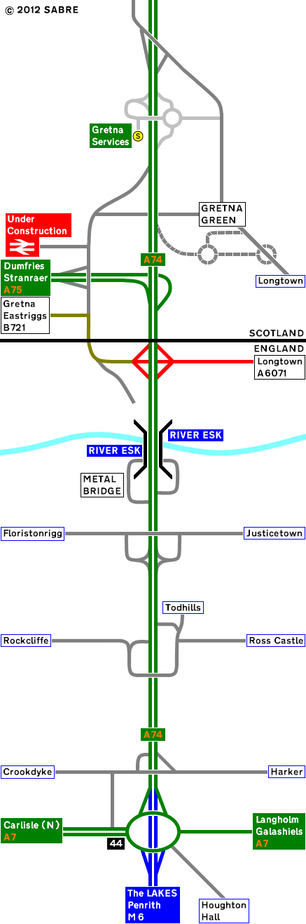
| 17:42, 31 March 2010 | 287 × 744 (42 KB) | Rileyrob (talk | contribs) | '''1991 Strip Map of the A74 I''' The only major change to the A74 at this end of the road is the upgrade of Gretna local Services to full MSA. The Bridges are built as D3M ready for the upgraded road. <small>''Originally uploaded to Coppermine on May 2 |
File usage
There are no pages that use this file.