Gallery:A8 (Ballasalla - Castletown)

From Roader's Digest: The SABRE Wiki
Jump to navigation Jump to search
A Roads in the Isle of Man > A8 (Ballasalla - Castletown)


This gallery has no child categories
A8 (Ballasalla - Castletown)
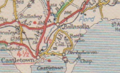
 
 
A8old-IOM.png
The original A8, B19, B22 and B32 near Ballasalla and Castletown on the Isle of Man.
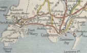
Iom-south-1926.jpg
The Michelin map from c1926 showing early road numbering on the Isle of Man. Area around Port Erin & Castletown
 

SABRE - The Society for All British and Irish Road Enthusiasts
Discuss - Digest - Discover - Help